Kresnice geodata
Kresnice (Moravče) is a populated place; located in Slovenia in Europe/Ljubljana (GMT+2) time zone. With population of 745 people, there are 331 cities with bigger population in this country. Compared to other cities in Slovenia, 68.3% of cities are located further ↑North; 55.3% of cities are located further →East and 54.3% of cities have higher elevation than Kresnice. Note1


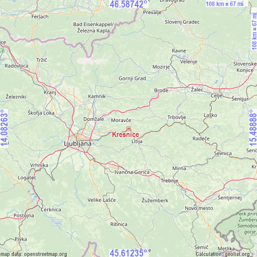
Kresnice GPS coordinates[2]
46° 6' 7.344" North, 14° 47' 8.7" East
| Map corner | latitude | longitude |
|---|---|---|
| Upper-left | 46.58742°, | 14.08263° |
| Center: | 46.10204°, | 14.78575° |
| Lower-right: | 45.61235°, | 15.48888° |
| Map W x H: | 108.4×108.4 km | = 67.4×67.4mi |
| max Lat: | 46.83694° ⇑68.3% North |
| Kresnice: | 46.10204° |
| min Lat: | ⇓31.7% South 45.47667° |
| min Long | Kresnice | max Long |
| 13.52639° | 14.78575° | 16.4975° |
| W 44.7%⇐ | ⇒55.3% E |
Elevation
Elevation of Kresnice is 288 m = 945 ft, and this is 37.6 m = 123 ft below average elevation for this country.
| Max E: |
1551 m = 5089 ft | 54.3% |
| Avg. | 325.6 m = 1068 ft | |
| Kresnice | 288 m = 945 ft | |
Min E: |
2 m = 7 ft | 45.7% |
See also: Slovenia elevation on elevation.city.
Geographical zone
Kresnice is located in North temperate zone (between Tropic of Cancer and the Arctic Circle). Distance of this North polar circle is 2275.1 km =1413.7 mi to North.| Distance of | km | miles | from Kresnice |
|---|---|---|---|
| North Pole | 4881 | 3032.9 | to North |
| Arctic Circle | 2275.1 | 1413.7 | to North |
| Tropic Cancer | 2520.1 | 1565.9 | to South |
| Equator | 5126.1 | 3185.2 | to South |


Nearby cities:
15 places around Kresnice: (largest is in red/bold)
• Dob
13.3 km =8.3 mi,  294°
294°
• Dolsko
8.4 km =5.2 mi,  262°
262°
• Ihan
12.9 km =8 mi,  279°
279°
• Izlake
13.7 km =8.5 mi,  67°
67°
• Kisovec
14.3 km =8.9 mi, 73°
• Krtina
11.5 km =7.1 mi,  296°
296°
• Litija
5.6 km =3.5 mi,  149°
149°
• Lukovica pri Domžalah
10.5 km =6.5 mi,  316°
316°
• Moravče
5 km =3.1 mi, 321°
• Prelog
13.6 km =8.5 mi, 281°
• Prevoje pri Šentvidu
11.7 km =7.3 mi,  308°
308°
• Senožeti
4.2 km =2.6 mi,  253°
253°
• Videm
11.7 km =7.3 mi, 259°
• Zaboršt
13.8 km =8.6 mi, 285°
• Šmartno pri Litiji
7.8 km =4.8 mi,  144°
144°
Sources, notices
• [Note1] Compared only with cities in Slovenia existing in our database
• [Src1] Map data: © OpenStreetMap contributors (CC-BY-SA)
• [Src2] Other city data from geonames.org with taken over terms of usage.
• [Src3] Geographical zone / Annual Mean Temperature by Robert A. Rohde @ Wikipedia
