Hrvatini geodata
Hrvatini (Koper-Capodistria) is a populated place; located in Slovenia in Europe/Ljubljana (GMT+2) time zone. With population of 1,232 people, there are 177 cities with bigger population in this country. Compared to other cities in Slovenia, 94% of cities are located further ↑North; 92.5% of cities are located further →East and 91.2% of cities have higher elevation than Hrvatini. Note1


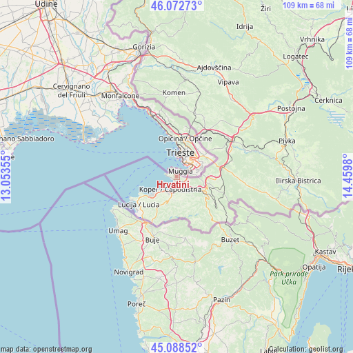
Hrvatini GPS coordinates[2]
45° 34' 58.008" North, 13° 45' 24.012" East
| Map corner | latitude | longitude |
|---|---|---|
| Upper-left | 46.07273°, | 13.05355° |
| Center: | 45.58278°, | 13.75667° |
| Lower-right: | 45.08852°, | 14.4598° |
| Map W x H: | 109.4×109.4 km | = 68×68mi |
| max Lat: | 46.83694° ⇑94% North |
| Hrvatini: | 45.58278° |
| min Lat: | ⇓6% South 45.47667° |
| min Long | Hrvatini | max Long |
| 13.52639° | 13.75667° | 16.4975° |
| W 7.5%⇐ | ⇒92.5% E |
Elevation
Elevation of Hrvatini is 160 m = 525 ft, and this is 165.6 m = 543 ft below average elevation for this country.
| Max E: |
1551 m = 5089 ft | 91.2% |
| Avg. | 325.6 m = 1068 ft | |
| Hrvatini | 160 m = 525 ft | |
Min E: |
2 m = 7 ft | 8.8% |
See also: Slovenia elevation on elevation.city.
Geographical zone
Hrvatini is located in North temperate zone (between Tropic of Cancer and the Arctic Circle). Distance of this North polar circle is 2332.8 km =1449.5 mi to North.| Distance of | km | miles | from Hrvatini |
|---|---|---|---|
| North Pole | 4938.7 | 3068.8 | to North |
| Arctic Circle | 2332.8 | 1449.5 | to North |
| Tropic Cancer | 2462.4 | 1530.1 | to South |
| Equator | 5068.3 | 3149.3 | to South |


Nearby cities:
15 places around Hrvatini: (largest is in red/bold)
• Ankaran
1.7 km =1.1 mi,  253°
253°
• Bertoki
4.2 km =2.6 mi,  168°
168°
• Bonini
6.3 km =3.9 mi,  161°
161°
• Bošamarin
7.1 km =4.4 mi,  193°
193°
• Dekani
5.8 km =3.6 mi,  129°
129°
• Kampel
7.7 km =4.8 mi, 186°
• Kolomban
1.1 km =0.7 mi,  319°
319°
• Koper
4.5 km =2.8 mi,  208°
208°
• Pobegi
5.7 km =3.5 mi,  147°
147°
• Prade
5 km =3.1 mi, 162°
• Spodnje Škofije
3 km =1.9 mi,  113°
113°
• Vanganel
7.4 km =4.6 mi, 168°
• Zgornje Škofije
3.8 km =2.4 mi,  118°
118°
• Čežarji
6.2 km =3.9 mi,  142°
142°
• Škocjan
5.5 km =3.4 mi, 174°
Sources, notices
• [Note1] Compared only with cities in Slovenia existing in our database
• [Src1] Map data: © OpenStreetMap contributors (CC-BY-SA)
• [Src2] Other city data from geonames.org with taken over terms of usage.
• [Src3] Geographical zone / Annual Mean Temperature by Robert A. Rohde @ Wikipedia
