Kampel geodata
Kampel (Koper-Capodistria) is a populated place; located in Slovenia in Europe/Ljubljana (GMT+2) time zone. With population of 699 people, there are 358 cities with bigger population in this country. Compared to other cities in Slovenia, 98.7% of cities are located further ↑North; 93% of cities are located further →East and 97.3% of cities have higher elevation than Kampel. Note1


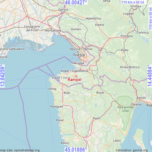
Kampel GPS coordinates[2]
45° 30' 49.392" North, 13° 44' 44.556" East
| Map corner | latitude | longitude |
|---|---|---|
| Upper-left | 46.00427°, | 13.04259° |
| Center: | 45.51372°, | 13.74571° |
| Lower-right: | 45.01886°, | 14.44884° |
| Map W x H: | 109.6×109.6 km | = 68.1×68.1mi |
| max Lat: | 46.83694° ⇑98.7% North |
| Kampel: | 45.51372° |
| min Lat: | ⇓1.3% South 45.47667° |
| min Long | Kampel | max Long |
| 13.52639° | 13.74571° | 16.4975° |
| W 7%⇐ | ⇒93% E |
Elevation
Elevation of Kampel is 53 m = 174 ft, and this is 272.6 m = 894 ft below average elevation for this country.
| Max E: |
1551 m = 5089 ft | 97.3% |
| Avg. | 325.6 m = 1068 ft | |
| Kampel | 53 m = 174 ft | |
Min E: |
2 m = 7 ft | 2.7% |
See also: Slovenia elevation on elevation.city.
Geographical zone
Kampel is located in North temperate zone (between Tropic of Cancer and the Arctic Circle). Distance of this North polar circle is 2340.5 km =1454.3 mi to North.| Distance of | km | miles | from Kampel |
|---|---|---|---|
| North Pole | 4946.4 | 3073.5 | to North |
| Arctic Circle | 2340.5 | 1454.3 | to North |
| Tropic Cancer | 2454.7 | 1525.3 | to South |
| Equator | 5060.7 | 3144.6 | to South |


Nearby cities:
15 places around Kampel: (largest is in red/bold)
• Bertoki
3.9 km =2.4 mi,  25°
25°
• Bonini
3.3 km =2.1 mi,  59°
59°
• Bošamarin
1.1 km =0.7 mi,  313°
313°
• Dekani
6.6 km =4.1 mi,  52°
52°
• Gažon
3.5 km =2.2 mi,  279°
279°
• Koper
3.9 km =2.4 mi,  341°
341°
• Korte
6.4 km =4 mi,  246°
246°
• Pobegi
4.9 km =3 mi, 53°
• Prade
3.8 km =2.4 mi,  38°
38°
• Sv. Anton
6.9 km =4.3 mi,  78°
78°
• Vanganel
2.4 km =1.5 mi, 80°
• Čežarji
5.4 km =3.4 mi, 58°
• Šalara
2.3 km =1.4 mi, 283°
• Škocjan
2.6 km =1.6 mi, 32°
• Šmarje
2.6 km =1.6 mi,  237°
237°
Sources, notices
• [Note1] Compared only with cities in Slovenia existing in our database
• [Src1] Map data: © OpenStreetMap contributors (CC-BY-SA)
• [Src2] Other city data from geonames.org with taken over terms of usage.
• [Src3] Geographical zone / Annual Mean Temperature by Robert A. Rohde @ Wikipedia
