Tālīn geodata
Tālīn (Tartus) is a seat of a third-order administrative division; located in Syria in Asia/Damascus (GMT+3) time zone. In our database, there are 87 cities with bigger population. Compared to other cities in Syria, 50.2% of cities are located further ↓South; 90.5% of cities are located further →East and 63.3% of cities have lower elevation than Tālīn. Note1


Tālīn GPS coordinates[2]
35° 8' 54.564" North, 36° 1' 58.368" East
| Map corner | latitude | longitude |
|---|---|---|
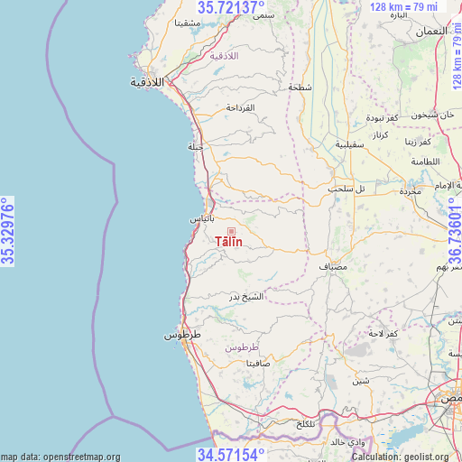
| Upper-left | 35.72137°, | 35.32976° |
| Center: | 35.14849°, | 36.03288° |
| Lower-right: | 34.57154°, | 36.73601° |
| Map W x H: | 127.8×127.8 km | = 79.4×79.4mi |
| max Lat: | 37.17701° ⇑49.8% North |
| Tālīn: | 35.14849° |
| min Lat: | ⇓50.2% South 32.39332° |
| min Long | Tālīn | max Long |
| 35.75572° | 36.03288° | 42.14006° |
| W 9.5%⇐ | ⇒90.5% E |
Elevation
Elevation of Tālīn is 569 m = 1867 ft, and this is 39.9 m = 131 ft above average elevation for this country.
| Max E: |
1640 m = 5381 ft | 36.7% |
| Tālīn | 569 m 1867 ft | |
| Avg. | 529.1 m = 1736 ft | |
Min E: |
4 m = 13 ft | 63.3% |
See also: Syria elevation on elevation.city.
Geographical zone
Tālīn is located in North temperate zone (between Tropic of Cancer and the Arctic Circle). Distance of this Northern Tropic circle is 1302.2 km =809.1 mi to South.| Distance of | km | miles | from Tālīn |
|---|---|---|---|
| North Pole | 6098.9 | 3789.7 | to North |
| Arctic Circle | 3493 | 2170.4 | to North |
| Tropic Cancer | 1302.2 | 809.1 | to South |
| Equator | 3908.1 | 2428.4 | to South |


Nearby cities:
15 places around Tālīn: (largest is in red/bold)
• Ad Dālīyah
14 km =8.7 mi,  45°
45°
• Al Qadmūs
12.8 km =8 mi,  115°
115°
• Al Qamşīyah
12.9 km =8 mi,  187°
187°
• Al Quţaylibīyah
16 km =9.9 mi,  354°
354°
• Al ‘Annāzah
6 km =3.7 mi,  29°
29°
• Ar Rawḑah
13.8 km =8.6 mi,  231°
231°
• As Sawdā
20.2 km =12.6 mi,  203°
203°
• Ash Shaykh Badr
18 km =11.2 mi,  165°
165°
• Aţ Ţawāḩīn
16.7 km =10.4 mi,  98°
98°
• Bayt Yāshūţ
19.5 km =12.1 mi,  22°
22°
• Brummānat al Mashāyikh
19.1 km =11.9 mi,  138°
138°
• Bāniyās
8.5 km =5.3 mi,  295°
295°
• Kaff al-Jaa
17.2 km =10.7 mi,  113°
113°
• Ḩammām Wāşil
9.6 km =6 mi,  149°
149°
• ‘Ayn ash Sharqīyah
21.3 km =13.2 mi, 16°
Sources, notices
• [Note1] Compared only with cities in Syria existing in our database
• [Src1] Map data: © OpenStreetMap contributors (CC-BY-SA)
• [Src2] Other city data from geonames.org with taken over terms of usage.
• [Src3] Geographical zone / Annual Mean Temperature by Robert A. Rohde @ Wikipedia
