Kaff al-Jaa geodata
Kaff al-Jaa (Tartus) is a populated place; located in Syria in Asia/Damascus (GMT+3) time zone. With population of 3,500 people, there are 84 cities with bigger population in this country. Compared to other cities in Syria, 51.2% of cities are located further ↑North; 75.3% of cities are located further →East and 88.3% of cities have lower elevation than Kaff al-Jaa. Note1


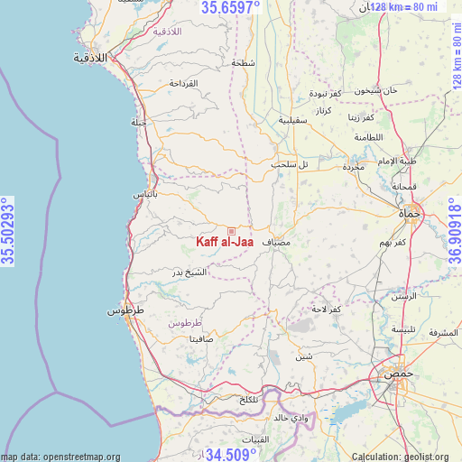
Kaff al-Jaa GPS coordinates[2]
35° 5' 10.968" North, 36° 12' 21.78" East
| Map corner | latitude | longitude |
|---|---|---|
| Upper-left | 35.6597°, | 35.50293° |
| Center: | 35.08638°, | 36.20605° |
| Lower-right: | 34.509°, | 36.90918° |
| Map W x H: | 127.9×127.9 km | = 79.5×79.5mi |
| max Lat: | 37.17701° ⇑51.2% North |
| Kaff al-Jaa: | 35.08638° |
| min Lat: | ⇓48.8% South 32.39332° |
| min Long | Kaff al-Jaa | max Long |
| 35.75572° | 36.20605° | 42.14006° |
| W 24.7%⇐ | ⇒75.3% E |
Elevation
Elevation of Kaff al-Jaa is 891 m = 2923 ft, and this is 361.9 m = 1187 ft above average elevation for this country.
| Max E: |
1640 m = 5381 ft | 11.7% |
| Kaff al-Jaa | 891 m 2923 ft | |
| Avg. | 529.1 m = 1736 ft | |
Min E: |
4 m = 13 ft | 88.3% |
See also: Syria elevation on elevation.city.
Geographical zone
Kaff al-Jaa is located in North temperate zone (between Tropic of Cancer and the Arctic Circle). Distance of this Northern Tropic circle is 1295.3 km =804.9 mi to South.| Distance of | km | miles | from Kaff al-Jaa |
|---|---|---|---|
| North Pole | 6105.8 | 3794 | to North |
| Arctic Circle | 3499.9 | 2174.7 | to North |
| Tropic Cancer | 1295.3 | 804.9 | to South |
| Equator | 3901.2 | 2424.1 | to South |


Nearby cities:
15 places around Kaff al-Jaa: (largest is in red/bold)
• Ad Dālīyah
17.6 km =10.9 mi,  341°
341°
• Al Qadmūs
4.4 km =2.7 mi,  287°
287°
• Al Qamşīyah
18.4 km =11.4 mi,  251°
251°
• Al ‘Annāzah
17.6 km =10.9 mi,  313°
313°
• Ash Shaykh Badr
15.3 km =9.5 mi,  226°
226°
• Aţ Ţawāḩīn
4.6 km =2.9 mi,  9°
9°
• Brummānat al Mashāyikh
8.2 km =5.1 mi,  203°
203°
• Duwayr Raslān
15.4 km =9.6 mi,  188°
188°
• Junaynat Raslān
19.1 km =11.9 mi, 202°
• Maşyāf
12.5 km =7.8 mi,  100°
100°
• Sabbah
20.6 km =12.8 mi,  172°
172°
• Tālīn
17.2 km =10.7 mi, 293°
• Wādī al ‘Uyūn
9.6 km =6 mi, 190°
• Ḩammām Wāşil
10.9 km =6.8 mi,  262°
262°
• ‘Ayn Ḩalāqīm
19.4 km =12.1 mi,  147°
147°
Sources, notices
• [Note1] Compared only with cities in Syria existing in our database
• [Src1] Map data: © OpenStreetMap contributors (CC-BY-SA)
• [Src2] Other city data from geonames.org with taken over terms of usage.
• [Src3] Geographical zone / Annual Mean Temperature by Robert A. Rohde @ Wikipedia
