Al Hinādī geodata
Al Hinādī (Latakia) is a seat of a third-order administrative division; located in Syria in Asia/Damascus (GMT+3) time zone. In our database, there are 87 cities with bigger population. Compared to other cities in Syria, 62.5% of cities are located further ↓South; 98.6% of cities are located further →East and 97.5% of cities have higher elevation than Al Hinādī. Note1


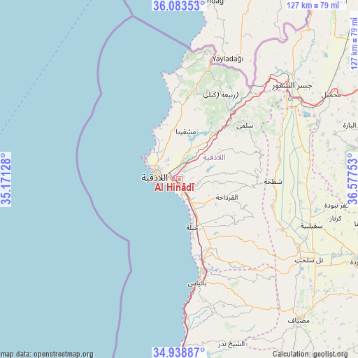
Al Hinādī GPS coordinates[2]
35° 30' 47.664" North, 35° 52' 27.84" East
| Map corner | latitude | longitude |
|---|---|---|
| Upper-left | 36.08353°, | 35.17128° |
| Center: | 35.51324°, | 35.8744° |
| Lower-right: | 34.93887°, | 36.57753° |
| Map W x H: | 127.3×127.3 km | = 79.1×79.1mi |
| max Lat: | 37.17701° ⇑37.5% North |
| Al Hinādī: | 35.51324° |
| min Lat: | ⇓62.5% South 32.39332° |
| min Long | Al Hinādī | max Long |
| 35.75572° | 35.8744° | 42.14006° |
| W 1.4%⇐ | ⇒98.6% E |
Elevation
Elevation of Al Hinādī is 73 m = 240 ft, and this is 456.1 m = 1496 ft below average elevation for this country.
| Max E: |
1640 m = 5381 ft | 97.5% |
| Avg. | 529.1 m = 1736 ft | |
| Al Hinādī | 73 m = 240 ft | |
Min E: |
4 m = 13 ft | 2.5% |
See also: Syria elevation on elevation.city.
Geographical zone
Al Hinādī is located in North temperate zone (between Tropic of Cancer and the Arctic Circle). Distance of this Northern Tropic circle is 1342.8 km =834.4 mi to South.| Distance of | km | miles | from Al Hinādī |
|---|---|---|---|
| North Pole | 6058.4 | 3764.5 | to North |
| Arctic Circle | 3452.5 | 2145.3 | to North |
| Tropic Cancer | 1342.8 | 834.4 | to South |
| Equator | 3948.7 | 2453.6 | to South |


Nearby cities:
15 places around Al Hinādī: (largest is in red/bold)
• Al Bahlūlīyah
15.8 km =9.8 mi,  29°
29°
• Al Fākhūrah
12.3 km =7.6 mi,  97°
97°
• Al Muzayri‘ah
17.8 km =11.1 mi,  83°
83°
• Al Qardāḩah
17.9 km =11.1 mi,  110°
110°
• Al Quţaylibīyah
27.7 km =17.2 mi,  152°
152°
• Al Ḩaffah
17 km =10.6 mi,  56°
56°
• Jablah
17.5 km =10.9 mi,  163°
163°
• Jawbat Burghāl
27.3 km =17 mi, 95°
• Latakia
7.9 km =4.9 mi,  285°
285°
• Şlinfah
29.9 km =18.6 mi,  71°
71°
• Ḩarf al Musaytirah
27.4 km =17 mi,  120°
120°
• ‘Ayn Shiqāq
19.3 km =12 mi,  133°
133°
• ‘Ayn al Bayḑā
15.9 km =9.9 mi,  4°
4°
• ‘Ayn ash Sharqīyah
28.7 km =17.8 mi, 134°
• ‘Ayn at Tīnah
21.3 km =13.2 mi, 74°
Sources, notices
• [Note1] Compared only with cities in Syria existing in our database
• [Src1] Map data: © OpenStreetMap contributors (CC-BY-SA)
• [Src2] Other city data from geonames.org with taken over terms of usage.
• [Src3] Geographical zone / Annual Mean Temperature by Robert A. Rohde @ Wikipedia
