Khon Buri geodata
Khon Buri (Nakhon Ratchasima) is a seat of a second-order administrative division; located in Thailand in Asia/Bangkok (GMT+7) time zone. With population of 18,596 people, there are 169 cities with bigger population in this country. Compared to other cities in Thailand, 59.4% of cities are located further ↑North; 69.6% of cities are located further ←West and 85.1% of cities have lower elevation than Khon Buri. Note1


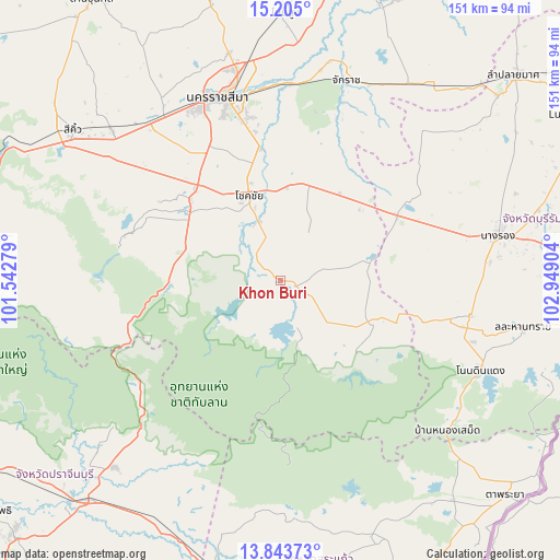
Khon Buri GPS coordinates[2]
14° 31' 31.476" North, 102° 14' 45.276" East
| Map corner | latitude | longitude |
|---|---|---|
| Upper-left | 15.205°, | 101.54279° |
| Center: | 14.52541°, | 102.24591° |
| Lower-right: | 13.84373°, | 102.94904° |
| Map W x H: | 151.4×151.4 km | = 94.1×94.1mi |
| max Lat: | 20.43353° ⇑59.4% North |
| Khon Buri: | 14.52541° |
| min Lat: | ⇓40.6% South 5.77434° |
| min Long | Khon Buri | max Long |
| 97.93288° | 102.24591° | 105.49506° |
| W 69.6%⇐ | ⇒30.4% E |
Elevation
Elevation of Khon Buri is 218 m = 715 ft, and this is 92.5 m = 303 ft above average elevation for this country.
| Max E: |
1011 m = 3317 ft | 14.9% |
| Khon Buri | 218 m 715 ft | |
| Avg. | 125.5 m = 412 ft | |
Min E: |
1 m = 3 ft | 85.1% |
See also: Thailand elevation on elevation.city.
Geographical zone
Khon Buri is located in North Torrid zone (between Equator and Tropic of Cancer). Distance of this Northern Tropic circle is 990.8 km =615.7 mi to North.| Distance of | km | miles | from Khon Buri |
|---|---|---|---|
| North Pole | 8392 | 5214.5 | to North |
| Arctic Circle | 5786.1 | 3595.3 | to North |
| Tropic Cancer | 990.8 | 615.7 | to North |
| Equator | 1615.1 | 1003.6 | to South |


Nearby cities:
15 places around Khon Buri: (largest is in red/bold)
• Chakkarat
57.2 km =35.5 mi,  18°
18°
• Chaloem Phra Kiat
53.4 km =33.2 mi,  2°
2°
• Chok Chai
24.2 km =15 mi,  338°
338°
• Kham Thale So
58.1 km =36.1 mi,  326°
326°
• Nakhon Ratchasima
51.9 km =32.2 mi, 342°
• Non Din Daeng
59 km =36.7 mi,  113°
113°
• Non Suwan
38.3 km =23.8 mi,  80°
80°
• Nong Bun Nak
27.1 km =16.8 mi,  28°
28°
• Nong Hong
59.2 km =36.8 mi,  52°
52°
• Nong Ki
36.2 km =22.5 mi,  60°
60°
• Pa Kham
52.5 km =32.6 mi,  100°
100°
• Pak Thong Chai
32.3 km =20.1 mi,  312°
312°
• Pakham
52.5 km =32.6 mi, 100°
• Soeng Sang
25.6 km =15.9 mi,  115°
115°
• Wang Nam Khiao
43.1 km =26.8 mi,  253°
253°
Sources, notices
• [Note1] Compared only with cities in Thailand existing in our database
• [Src1] Map data: © OpenStreetMap contributors (CC-BY-SA)
• [Src2] Other city data from geonames.org with taken over terms of usage.
• [Src3] Geographical zone / Annual Mean Temperature by Robert A. Rohde @ Wikipedia
