Hihifo geodata
Hihifo (Niuas) is a seat of a first-order administrative division; located in Tonga in Pacific/Tongatapu (GMT+13) time zone. With population of 815 people, there are 9 cities with bigger population in this country. Compared to other cities in Tonga, 100% of cities are located further ↓South; 100% of cities are located further ←West and 77.8% of cities have higher elevation than Hihifo. Note1


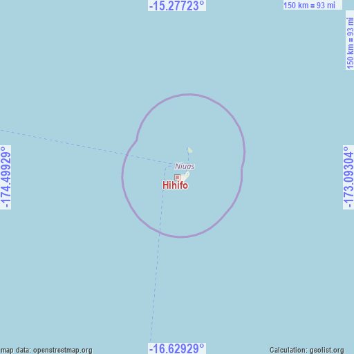
Hihifo GPS coordinates[2]
15° 57' 15.84" South, 173° 47' 46.176" West
| Map corner | latitude | longitude |
|---|---|---|
| Upper-left | -15.27723°, | -174.49929° |
| Center: | -15.9544°, | -173.79616° |
| Lower-right: | -16.62929°, | -173.09304° |
| Map W x H: | 150.3×150.3 km | = 93.4×93.4mi |
| max Lat: | -15.9544° ⇑0% North |
| Hihifo: | -15.9544° |
| min Lat: | ⇓100% South -21.33333° |
| min Long | Hihifo | max Long |
| -175.21333° | -173.79616° | -173.79616° |
| W 100%⇐ | ⇒0% E |
Elevation
Elevation of Hihifo is 6 m = 20 ft, and this is 2.5 m = 8 ft below average elevation for this country.
| Max E: |
13 m = 43 ft | 77.8% |
| Avg. | 8.5 m = 28 ft | |
| Hihifo | 6 m = 20 ft | |
Min E: |
5 m = 16 ft | 22.2% |
See also: Tonga elevation on elevation.city.
Geographical zone
Hihifo is located in South Torrid zone (between Equator and Tropic of Capricorn). Distance of this Southern Tropic circle is 832 km =517 mi to South.| Distance of | km | miles | from Hihifo |
|---|---|---|---|
| Equator | 1774 | 1102.3 | to North |
| Tropic Capricorn | 832 | 517 | to South |
| Antarctic Circle | 5627.2 | 3496.6 | to South |
| South Pole | 8233.1 | 5115.8 | to South |


Nearby cities:
2 places around Hihifo: (largest is in red/bold)
• Neiafu
300.5 km =186.7 mi,  183°
183°
• Pangai
433.3 km =269.2 mi,  187°
187°
Sources, notices
• [Note1] Compared only with cities in Tonga existing in our database
• [Src1] Map data: © OpenStreetMap contributors (CC-BY-SA)
• [Src2] Other city data from geonames.org with taken over terms of usage.
• [Src3] Geographical zone / Annual Mean Temperature by Robert A. Rohde @ Wikipedia
