Tatakamotonga geodata
Tatakamotonga (Tongatapu) is a populated place; located in Tonga in Pacific/Tongatapu (GMT+13) time zone. With population of 3,000 people, there are 4 cities with bigger population in this country. Compared to other cities in Tonga, 77.8% of cities are located further ↑North; 66.7% of cities are located further →East and 55.6% of cities have lower elevation than Tatakamotonga. Note1


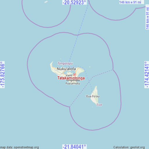
Tatakamotonga GPS coordinates[2]
21° 11' 10.572" South, 175° 7' 28.308" West
| Map corner | latitude | longitude |
|---|---|---|
| Upper-left | -20.52923°, | -175.82766° |
| Center: | -21.18627°, | -175.12453° |
| Lower-right: | -21.84041°, | -174.42141° |
| Map W x H: | 145.8×145.8 km | = 90.6×90.6mi |
| max Lat: | -15.9544° ⇑77.8% North |
| Tatakamotonga: | -21.18627° |
| min Lat: | ⇓22.2% South -21.33333° |
| min Long | Tatakamotonga | max Long |
| -175.21333° | -175.12453° | -173.79616° |
| W 33.3%⇐ | ⇒66.7% E |
Elevation
Elevation of Tatakamotonga is 9 m = 30 ft, and this is 0.5 m = 2 ft above average elevation for this country.
| Max E: |
13 m = 43 ft | 44.4% |
| Tatakamotonga | 9 m 30 ft | |
| Avg. | 8.5 m = 28 ft | |
Min E: |
5 m = 16 ft | 55.6% |
See also: Tonga elevation on elevation.city.
Geographical zone
Tatakamotonga is located in South Torrid zone (between Equator and Tropic of Capricorn). Distance of this Southern Tropic circle is 250.2 km =155.5 mi to South.| Distance of | km | miles | from Tatakamotonga |
|---|---|---|---|
| Equator | 2355.7 | 1463.8 | to North |
| Tropic Capricorn | 250.2 | 155.5 | to South |
| Antarctic Circle | 5045.5 | 3135.1 | to South |
| South Pole | 7651.4 | 4754.4 | to South |


Nearby cities:
8 places around Tatakamotonga: (largest is in red/bold)
• Haveluloto
10 km =6.2 mi,  292°
292°
• Kolonga
8.4 km =5.2 mi,  45°
45°
• Lapaha
1.2 km =0.7 mi,  37°
37°
• Neiafu
306.1 km =190.2 mi,  22°
22°
• Nuku‘alofa
9.6 km =6 mi,  303°
303°
• Pangai
172.3 km =107.1 mi,  27°
27°
• Vaini
5.5 km =3.4 mi,  262°
262°
• ‘Ohonua
24.4 km =15.2 mi,  132°
132°
Sources, notices
• [Note1] Compared only with cities in Tonga existing in our database
• [Src1] Map data: © OpenStreetMap contributors (CC-BY-SA)
• [Src2] Other city data from geonames.org with taken over terms of usage.
• [Src3] Geographical zone / Annual Mean Temperature by Robert A. Rohde @ Wikipedia
