Telminar geodata
Telminar (Mardin) is a populated place; located in Turkey in Europe/Istanbul (GMT+3) time zone. With population of 1,441 people, there are 1015 cities with bigger population in this country. Compared to other cities in Turkey, 86% of cities are located further ↑North; 85.2% of cities are located further ←West and 60.3% of cities have higher elevation than Telminar. Note1


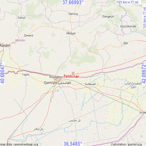
Telminar GPS coordinates[2]
37° 6' 40.644" North, 41° 23' 0.924" East
| Map corner | latitude | longitude |
|---|---|---|
| Upper-left | 37.66993°, | 40.68047° |
| Center: | 37.11129°, | 41.38359° |
| Lower-right: | 36.5485°, | 42.08672° |
| Map W x H: | 124.7×124.7 km | = 77.5×77.5mi |
| max Lat: | 42.02683° ⇑86% North |
| Telminar: | 37.11129° |
| min Lat: | ⇓14% South 35.9025° |
| min Long | Telminar | max Long |
| 25.90902° | 41.38359° | 44.60099° |
| W 85.2%⇐ | ⇒14.8% E |
Elevation
Elevation of Telminar is 502 m = 1647 ft, and this is 215.4 m = 707 ft below average elevation for this country.
| Max E: |
2682 m = 8799 ft | 60.3% |
| Avg. | 717.4 m = 2354 ft | |
| Telminar | 502 m = 1647 ft | |
Min E: |
0 m = 0 ft | 39.7% |
See also: Turkey elevation on elevation.city.
Geographical zone
Telminar is located in North temperate zone (between Tropic of Cancer and the Arctic Circle). Distance of this Northern Tropic circle is 1520.5 km =944.8 mi to South.| Distance of | km | miles | from Telminar |
|---|---|---|---|
| North Pole | 5880.7 | 3654.1 | to North |
| Arctic Circle | 3274.8 | 2034.9 | to North |
| Tropic Cancer | 1520.5 | 944.8 | to South |
| Equator | 4126.4 | 2564 | to South |


Nearby cities:
15 places around Telminar: (largest is in red/bold)
• Aksoy
28.6 km =17.8 mi,  63°
63°
• Bahçebaşı
13.2 km =8.2 mi,  271°
271°
• Duruca
6.8 km =4.2 mi,  252°
252°
• Girmeli
3.2 km =2 mi,  90°
90°
• Hasantepe
9.7 km =6 mi,  79°
79°
• Kayalıpınar
28 km =17.4 mi,  330°
330°
• Kutlubey
28.4 km =17.6 mi,  320°
320°
• Nusaybin
15.7 km =9.8 mi, 253°
• Odabaşı
7.1 km =4.4 mi,  95°
95°
• Sivrice
18.9 km =11.7 mi,  347°
347°
• Tepealtı
2.2 km =1.4 mi,  218°
218°
• Toptepe
20.5 km =12.7 mi, 324°
• Yayvantepe
24.4 km =15.2 mi,  29°
29°
• Çatalözü
15.1 km =9.4 mi,  264°
264°
• Özbek
28.4 km =17.6 mi, 75°
Sources, notices
• [Note1] Compared only with cities in Turkey existing in our database
• [Src1] Map data: © OpenStreetMap contributors (CC-BY-SA)
• [Src2] Other city data from geonames.org with taken over terms of usage.
• [Src3] Geographical zone / Annual Mean Temperature by Robert A. Rohde @ Wikipedia
