Nusaybin geodata
Nusaybin (Mardin) is a seat of a second-order administrative division; located in Turkey in Europe/Istanbul (GMT+3) time zone. With population of 88,977 people, there are 98 cities with bigger population in this country. Compared to other cities in Turkey, 86.8% of cities are located further ↑North; 83.1% of cities are located further ←West and 61.8% of cities have higher elevation than Nusaybin. Note1


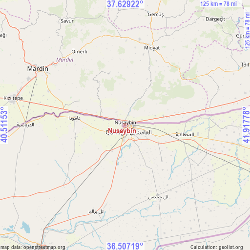
Nusaybin GPS coordinates[2]
37° 4' 13.008" North, 41° 12' 52.74" East
| Map corner | latitude | longitude |
|---|---|---|
| Upper-left | 37.62922°, | 40.51153° |
| Center: | 37.07028°, | 41.21465° |
| Lower-right: | 36.50719°, | 41.91778° |
| Map W x H: | 124.8×124.8 km | = 77.5×77.5mi |
| max Lat: | 42.02683° ⇑86.8% North |
| Nusaybin: | 37.07028° |
| min Lat: | ⇓13.2% South 35.9025° |
| min Long | Nusaybin | max Long |
| 25.90902° | 41.21465° | 44.60099° |
| W 83.1%⇐ | ⇒16.9% E |
Elevation
Elevation of Nusaybin is 476 m = 1562 ft, and this is 241.4 m = 792 ft below average elevation for this country.
| Max E: |
2682 m = 8799 ft | 61.8% |
| Avg. | 717.4 m = 2354 ft | |
| Nusaybin | 476 m = 1562 ft | |
Min E: |
0 m = 0 ft | 38.2% |
See also: Nusaybin elevation on elevation.city.
Geographical zone
Nusaybin is located in North temperate zone (between Tropic of Cancer and the Arctic Circle). Distance of this Northern Tropic circle is 1515.9 km =941.9 mi to South.| Distance of | km | miles | from Nusaybin |
|---|---|---|---|
| North Pole | 5885.2 | 3656.9 | to North |
| Arctic Circle | 3279.3 | 2037.7 | to North |
| Tropic Cancer | 1515.9 | 941.9 | to South |
| Equator | 4121.8 | 2561.2 | to South |


Nearby cities:
15 places around Nusaybin: (largest is in red/bold)
• Akarsu
22.6 km =14 mi,  320°
320°
• Bahçebaşı
5.1 km =3.2 mi,  19°
19°
• Cinatamiho
27.7 km =17.2 mi, 324°
• Dallıağaç
28.8 km =17.9 mi,  331°
331°
• Dara
26 km =16.2 mi,  297°
297°
• Duruca
8.8 km =5.5 mi,  73°
73°
• Girmeli
18.7 km =11.6 mi,  75°
75°
• Hasantepe
25.3 km =15.7 mi, 75°
• Kutlubey
26.5 km =16.5 mi,  352°
352°
• Odabaşı
22.3 km =13.9 mi, 80°
• Sivrice
25.3 km =15.7 mi,  25°
25°
• Telminar
15.7 km =9.8 mi, 73°
• Tepealtı
13.9 km =8.6 mi, 78°
• Toptepe
21.4 km =13.3 mi,  8°
8°
• Çatalözü
3 km =1.9 mi,  359°
359°
Sources, notices
• [Note1] Compared only with cities in Turkey existing in our database
• [Src1] Map data: © OpenStreetMap contributors (CC-BY-SA)
• [Src2] Other city data from geonames.org with taken over terms of usage.
• [Src3] Geographical zone / Annual Mean Temperature by Robert A. Rohde @ Wikipedia
