Tepe geodata
Tepe (Diyarbakır) is a seat of a third-order administrative division; located in Turkey in Europe/Istanbul (GMT+3) time zone. In our database, there are 1323 cities with bigger population. Compared to other cities in Turkey, 68.8% of cities are located further ↑North; 79.2% of cities are located further ←West and 57.8% of cities have higher elevation than Tepe. Note1


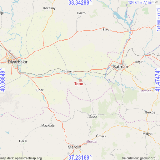
Tepe GPS coordinates[2]
37° 47' 21.948" North, 40° 46' 17.796" East
| Map corner | latitude | longitude |
|---|---|---|
| Upper-left | 38.34299°, | 40.06849° |
| Center: | 37.78943°, | 40.77161° |
| Lower-right: | 37.23169°, | 41.47474° |
| Map W x H: | 123.6×123.6 km | = 76.8×76.8mi |
| max Lat: | 42.02683° ⇑68.8% North |
| Tepe: | 37.78943° |
| min Lat: | ⇓31.2% South 35.9025° |
| min Long | Tepe | max Long |
| 25.90902° | 40.77161° | 44.60099° |
| W 79.2%⇐ | ⇒20.8% E |
Elevation
Elevation of Tepe is 541 m = 1775 ft, and this is 176.4 m = 579 ft below average elevation for this country.
| Max E: |
2682 m = 8799 ft | 57.8% |
| Avg. | 717.4 m = 2354 ft | |
| Tepe | 541 m = 1775 ft | |
Min E: |
0 m = 0 ft | 42.2% |
See also: Turkey elevation on elevation.city.
Geographical zone
Tepe is located in North temperate zone (between Tropic of Cancer and the Arctic Circle). Distance of this Northern Tropic circle is 1595.9 km =991.6 mi to South.| Distance of | km | miles | from Tepe |
|---|---|---|---|
| North Pole | 5805.3 | 3607.2 | to North |
| Arctic Circle | 3199.4 | 1988 | to North |
| Tropic Cancer | 1595.9 | 991.6 | to South |
| Equator | 4201.8 | 2610.9 | to South |


Nearby cities:
15 places around Tepe: (largest is in red/bold)
• Aralık
9.2 km =5.7 mi,  299°
299°
• Başhan
16 km =9.9 mi,  129°
129°
• Bismil
11.6 km =7.2 mi, 302°
• Doruk
9.8 km =6.1 mi,  169°
169°
• Güngeçti
17.9 km =11.1 mi,  44°
44°
• Harmanlı
8.5 km =5.3 mi,  143°
143°
• Kavsan
17.8 km =11.1 mi,  214°
214°
• Kazancı
15.2 km =9.4 mi,  262°
262°
• Köseli
15.4 km =9.6 mi,  290°
290°
• Meydanlık
11.2 km =7 mi,  249°
249°
• Salat
11.6 km =7.2 mi,  60°
60°
• Soylu
15.9 km =9.9 mi, 165°
• Türkmenhacı
14.2 km =8.8 mi,  277°
277°
• Yukarı Harım
15.3 km =9.5 mi,  338°
338°
• Şenocak
16.9 km =10.5 mi,  203°
203°
Sources, notices
• [Note1] Compared only with cities in Turkey existing in our database
• [Src1] Map data: © OpenStreetMap contributors (CC-BY-SA)
• [Src2] Other city data from geonames.org with taken over terms of usage.
• [Src3] Geographical zone / Annual Mean Temperature by Robert A. Rohde @ Wikipedia
