Soylu geodata
Soylu (Mardin) is a populated place; located in Turkey in Europe/Istanbul (GMT+3) time zone. With population of 588 people, there are 1261 cities with bigger population in this country. Compared to other cities in Turkey, 71.5% of cities are located further ↑North; 79.6% of cities are located further ←West and 55.3% of cities have lower elevation than Soylu. Note1


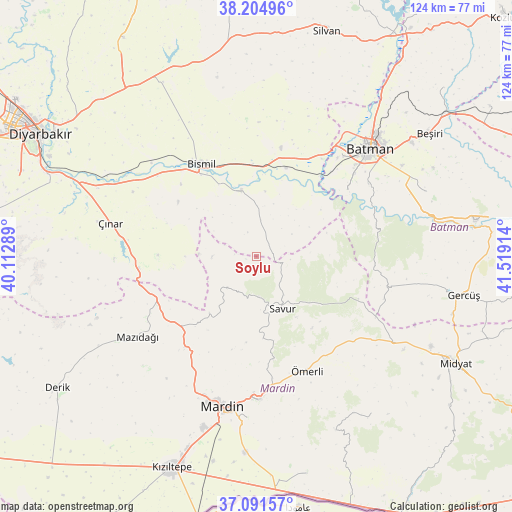
Soylu GPS coordinates[2]
37° 39' 1.26" North, 40° 48' 57.636" East
| Map corner | latitude | longitude |
|---|---|---|
| Upper-left | 38.20496°, | 40.11289° |
| Center: | 37.65035°, | 40.81601° |
| Lower-right: | 37.09157°, | 41.51914° |
| Map W x H: | 123.8×123.8 km | = 76.9×76.9mi |
| max Lat: | 42.02683° ⇑71.5% North |
| Soylu: | 37.65035° |
| min Lat: | ⇓28.5% South 35.9025° |
| min Long | Soylu | max Long |
| 25.90902° | 40.81601° | 44.60099° |
| W 79.6%⇐ | ⇒20.4% E |
Elevation
Elevation of Soylu is 795 m = 2608 ft, and this is 77.6 m = 255 ft above average elevation for this country.
| Max E: |
2682 m = 8799 ft | 44.7% |
| Soylu | 795 m 2608 ft | |
| Avg. | 717.4 m = 2354 ft | |
Min E: |
0 m = 0 ft | 55.3% |
See also: Turkey elevation on elevation.city.
Geographical zone
Soylu is located in North temperate zone (between Tropic of Cancer and the Arctic Circle). Distance of this Northern Tropic circle is 1580.4 km =982 mi to South.| Distance of | km | miles | from Soylu |
|---|---|---|---|
| North Pole | 5820.7 | 3616.8 | to North |
| Arctic Circle | 3214.8 | 1997.6 | to North |
| Tropic Cancer | 1580.4 | 982 | to South |
| Equator | 4186.3 | 2601.2 | to South |


Nearby cities:
15 places around Soylu: (largest is in red/bold)
• Avine
11.3 km =7 mi,  220°
220°
• Bağlıca
17.9 km =11.1 mi, 219°
• Başhan
10 km =6.2 mi,  57°
57°
• Başkavak
11.4 km =7.1 mi,  146°
146°
• Cillin
13.1 km =8.1 mi,  242°
242°
• Doruk
6.2 km =3.9 mi,  340°
340°
• Evkuran
13.1 km =8.1 mi,  85°
85°
• Harmanlı
8.7 km =5.4 mi,  7°
7°
• Harmantepe
17.8 km =11.1 mi,  71°
71°
• Kavsan
13.9 km =8.6 mi,  272°
272°
• Kayatepe
17.6 km =10.9 mi, 146°
• Meydanlık
18.5 km =11.5 mi,  308°
308°
• Savur
13.9 km =8.6 mi,  156°
156°
• Tepe
15.9 km =9.9 mi,  345°
345°
• Şenocak
10.7 km =6.6 mi, 270°
Sources, notices
• [Note1] Compared only with cities in Turkey existing in our database
• [Src1] Map data: © OpenStreetMap contributors (CC-BY-SA)
• [Src2] Other city data from geonames.org with taken over terms of usage.
• [Src3] Geographical zone / Annual Mean Temperature by Robert A. Rohde @ Wikipedia
