Ovabağ geodata
Ovabağ (Diyarbakır) is a seat of a third-order administrative division; located in Turkey in Europe/Istanbul (GMT+3) time zone. In our database, there are 1323 cities with bigger population. Compared to other cities in Turkey, 70.4% of cities are located further ↑North; 73.4% of cities are located further ←West and 70.5% of cities have lower elevation than Ovabağ. Note1


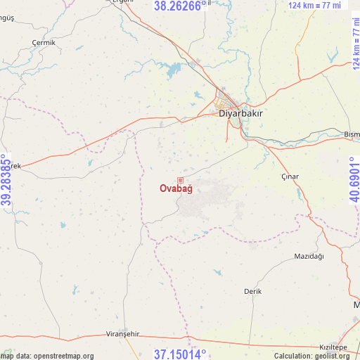
Ovabağ GPS coordinates[2]
37° 42' 30.564" North, 39° 59' 13.092" East
| Map corner | latitude | longitude |
|---|---|---|
| Upper-left | 38.26266°, | 39.28385° |
| Center: | 37.70849°, | 39.98697° |
| Lower-right: | 37.15014°, | 40.6901° |
| Map W x H: | 123.7×123.7 km | = 76.9×76.9mi |
| max Lat: | 42.02683° ⇑70.4% North |
| Ovabağ: | 37.70849° |
| min Lat: | ⇓29.6% South 35.9025° |
| min Long | Ovabağ | max Long |
| 25.90902° | 39.98697° | 44.60099° |
| W 73.4%⇐ | ⇒26.6% E |
Elevation
Elevation of Ovabağ is 1033 m = 3389 ft, and this is 315.6 m = 1035 ft above average elevation for this country.
| Max E: |
2682 m = 8799 ft | 29.5% |
| Ovabağ | 1033 m 3389 ft | |
| Avg. | 717.4 m = 2354 ft | |
Min E: |
0 m = 0 ft | 70.5% |
See also: Turkey elevation on elevation.city.
Geographical zone
Ovabağ is located in North temperate zone (between Tropic of Cancer and the Arctic Circle). Distance of this Northern Tropic circle is 1586.9 km =986.1 mi to South.| Distance of | km | miles | from Ovabağ |
|---|---|---|---|
| North Pole | 5814.3 | 3612.8 | to North |
| Arctic Circle | 3208.4 | 1993.6 | to North |
| Tropic Cancer | 1586.9 | 986.1 | to South |
| Equator | 4192.8 | 2605.3 | to South |


Nearby cities:
15 places around Ovabağ: (largest is in red/bold)
• Ahmetli
53.5 km =33.2 mi,  347°
347°
• Ambar
50.2 km =31.2 mi,  71°
71°
• Bağlar
29.8 km =18.5 mi,  40°
40°
• Demirci
38.1 km =23.7 mi,  210°
210°
• Derik
45.5 km =28.3 mi,  147°
147°
• Diyarbakır
30.5 km =19 mi, 41°
• Karacadağ
31 km =19.3 mi,  274°
274°
• Kayapınar
30.5 km =19 mi,  33°
33°
• Kerh
50.7 km =31.5 mi,  75°
75°
• Mazıdağı
50.5 km =31.4 mi,  120°
120°
• Sur
31.1 km =19.3 mi, 42°
• Yaprakbaşı
49.6 km =30.8 mi,  97°
97°
• Yenişehir
29.1 km =18.1 mi, 27°
• Yolboyu
21.1 km =13.1 mi,  3°
3°
• Çınar
37 km =23 mi,  87°
87°
Sources, notices
• [Note1] Compared only with cities in Turkey existing in our database
• [Src1] Map data: © OpenStreetMap contributors (CC-BY-SA)
• [Src2] Other city data from geonames.org with taken over terms of usage.
• [Src3] Geographical zone / Annual Mean Temperature by Robert A. Rohde @ Wikipedia
