Bozalan geodata
Bozalan (Şırnak) is a populated place; located in Turkey in Europe/Istanbul (GMT+3) time zone. With population of 2,007 people, there are 954 cities with bigger population in this country. Compared to other cities in Turkey, 79.5% of cities are located further ↑North; 92.3% of cities are located further ←West and 60.9% of cities have higher elevation than Bozalan. Note1


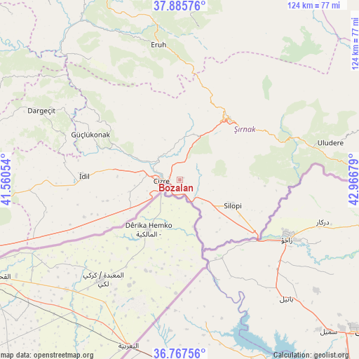
Bozalan GPS coordinates[2]
37° 19' 43.464" North, 42° 15' 49.176" East
| Map corner | latitude | longitude |
|---|---|---|
| Upper-left | 37.88576°, | 41.56054° |
| Center: | 37.32874°, | 42.26366° |
| Lower-right: | 36.76756°, | 42.96679° |
| Map W x H: | 124.3×124.3 km | = 77.2×77.2mi |
| max Lat: | 42.02683° ⇑79.5% North |
| Bozalan: | 37.32874° |
| min Lat: | ⇓20.5% South 35.9025° |
| min Long | Bozalan | max Long |
| 25.90902° | 42.26366° | 44.60099° |
| W 92.3%⇐ | ⇒7.7% E |
Elevation
Elevation of Bozalan is 494 m = 1621 ft, and this is 223.4 m = 733 ft below average elevation for this country.
| Max E: |
2682 m = 8799 ft | 60.9% |
| Avg. | 717.4 m = 2354 ft | |
| Bozalan | 494 m = 1621 ft | |
Min E: |
0 m = 0 ft | 39.1% |
See also: Turkey elevation on elevation.city.
Geographical zone
Bozalan is located in North temperate zone (between Tropic of Cancer and the Arctic Circle). Distance of this Northern Tropic circle is 1544.6 km =959.8 mi to South.| Distance of | km | miles | from Bozalan |
|---|---|---|---|
| North Pole | 5856.5 | 3639.1 | to North |
| Arctic Circle | 3250.6 | 2019.8 | to North |
| Tropic Cancer | 1544.6 | 959.8 | to South |
| Equator | 4150.6 | 2579.1 | to South |


Nearby cities:
15 places around Bozalan: (largest is in red/bold)
• Bostancı
17.8 km =11.1 mi,  160°
160°
• Cibri
15.8 km =9.8 mi,  248°
248°
• Cizre
7 km =4.3 mi,  271°
271°
• Dicle
17.9 km =11.1 mi,  255°
255°
• Doruklu
10.3 km =6.4 mi,  142°
142°
• Düzova
15.8 km =9.8 mi,  280°
280°
• Katran
16 km =9.9 mi,  238°
238°
• Kavallı
19 km =11.8 mi,  133°
133°
• Kumçatı
15.4 km =9.6 mi,  7°
7°
• Kızılsu
15.1 km =9.4 mi,  336°
336°
• Razvaliny Ayinvan
8.3 km =5.2 mi, 131°
• Rubaikale
14.1 km =8.8 mi,  148°
148°
• Sulak
11.9 km =7.4 mi, 251°
• Yeniköy
15.6 km =9.7 mi,  114°
114°
• Yeşilyurt
11.3 km =7 mi, 257°
Sources, notices
• [Note1] Compared only with cities in Turkey existing in our database
• [Src1] Map data: © OpenStreetMap contributors (CC-BY-SA)
• [Src2] Other city data from geonames.org with taken over terms of usage.
• [Src3] Geographical zone / Annual Mean Temperature by Robert A. Rohde @ Wikipedia
