Boybeyi geodata
Boybeyi (Şanlıurfa) is a populated place; located in Turkey in Europe/Istanbul (GMT+3) time zone. With population of 812 people, there are 1144 cities with bigger population in this country. Compared to other cities in Turkey, 90.8% of cities are located further ↑North; 65.2% of cities are located further ←West and 60.3% of cities have higher elevation than Boybeyi. Note1


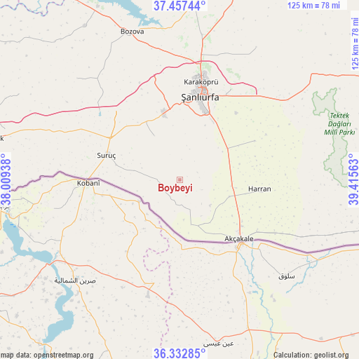
Boybeyi GPS coordinates[2]
36° 53' 49.992" North, 38° 42' 45" East
| Map corner | latitude | longitude |
|---|---|---|
| Upper-left | 37.45744°, | 38.00938° |
| Center: | 36.89722°, | 38.7125° |
| Lower-right: | 36.33285°, | 39.41563° |
| Map W x H: | 125×125 km | = 77.7×77.7mi |
| max Lat: | 42.02683° ⇑90.8% North |
| Boybeyi: | 36.89722° |
| min Lat: | ⇓9.2% South 35.9025° |
| min Long | Boybeyi | max Long |
| 25.90902° | 38.7125° | 44.60099° |
| W 65.2%⇐ | ⇒34.8% E |
Elevation
Elevation of Boybeyi is 502 m = 1647 ft, and this is 215.4 m = 707 ft below average elevation for this country.
| Max E: |
2682 m = 8799 ft | 60.3% |
| Avg. | 717.4 m = 2354 ft | |
| Boybeyi | 502 m = 1647 ft | |
Min E: |
0 m = 0 ft | 39.7% |
See also: Turkey elevation on elevation.city.
Geographical zone
Boybeyi is located in North temperate zone (between Tropic of Cancer and the Arctic Circle). Distance of this Northern Tropic circle is 1496.7 km =930 mi to South.| Distance of | km | miles | from Boybeyi |
|---|---|---|---|
| North Pole | 5904.5 | 3668.9 | to North |
| Arctic Circle | 3298.6 | 2049.7 | to North |
| Tropic Cancer | 1496.7 | 930 | to South |
| Equator | 4102.6 | 2549.2 | to South |


Nearby cities:
15 places around Boybeyi: (largest is in red/bold)
• Aşağı Beğdeş
20.5 km =12.7 mi,  116°
116°
• Aşağı Oylum
15.4 km =9.6 mi,  256°
256°
• Dorumali
16.2 km =10.1 mi,  129°
129°
• Gyundash
20.3 km =12.6 mi,  154°
154°
• Haktanır
14.4 km =8.9 mi,  109°
109°
• Karatepe
14.9 km =9.3 mi,  89°
89°
• Milköy
8.7 km =5.4 mi, 132°
• Nimet
13.7 km =8.5 mi,  174°
174°
• Ozanlar
17.4 km =10.8 mi,  72°
72°
• Parapara
21.5 km =13.4 mi, 74°
• Payamlı
17.8 km =11.1 mi,  330°
330°
• Yediyol
22.1 km =13.7 mi,  61°
61°
• Yukarı Beğdeş
18 km =11.2 mi, 108°
• Yukarı Çaykuyu
11.4 km =7.1 mi,  17°
17°
• Şehit Nusretbey
6 km =3.7 mi,  159°
159°
Sources, notices
• [Note1] Compared only with cities in Turkey existing in our database
• [Src1] Map data: © OpenStreetMap contributors (CC-BY-SA)
• [Src2] Other city data from geonames.org with taken over terms of usage.
• [Src3] Geographical zone / Annual Mean Temperature by Robert A. Rohde @ Wikipedia
