Büyükçat geodata
Büyükçat (Hatay) is a populated place; located in Turkey in Europe/Istanbul (GMT+3) time zone. With population of 1,481 people, there are 1010 cities with bigger population in this country. Compared to other cities in Turkey, 99.4% of cities are located further ↑North; 50.7% of cities are located further ←West and 88.9% of cities have higher elevation than Büyükçat. Note1


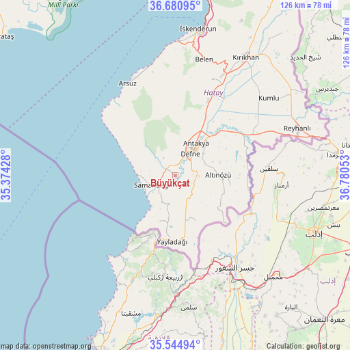
Büyükçat GPS coordinates[2]
36° 6' 54" North, 36° 4' 38.64" East
| Map corner | latitude | longitude |
|---|---|---|
| Upper-left | 36.68095°, | 35.37428° |
| Center: | 36.115°, | 36.0774° |
| Lower-right: | 35.54494°, | 36.78053° |
| Map W x H: | 126.3×126.3 km | = 78.5×78.5mi |
| max Lat: | 42.02683° ⇑99.4% North |
| Büyükçat: | 36.115° |
| min Lat: | ⇓0.6% South 35.9025° |
| min Long | Büyükçat | max Long |
| 25.90902° | 36.0774° | 44.60099° |
| W 50.7%⇐ | ⇒49.3% E |
Elevation
Elevation of Büyükçat is 44 m = 144 ft, and this is 673.4 m = 2209 ft below average elevation for this country.
| Max E: |
2682 m = 8799 ft | 88.9% |
| Avg. | 717.4 m = 2354 ft | |
| Büyükçat | 44 m = 144 ft | |
Min E: |
0 m = 0 ft | 11.1% |
See also: Turkey elevation on elevation.city.
Geographical zone
Büyükçat is located in North temperate zone (between Tropic of Cancer and the Arctic Circle). Distance of this Northern Tropic circle is 1409.7 km =875.9 mi to South.| Distance of | km | miles | from Büyükçat |
|---|---|---|---|
| North Pole | 5991.5 | 3722.9 | to North |
| Arctic Circle | 3385.6 | 2103.7 | to North |
| Tropic Cancer | 1409.7 | 875.9 | to South |
| Equator | 4015.6 | 2495.2 | to South |


Nearby cities:
15 places around Büyükçat: (largest is in red/bold)
• Aşağıokçular
9 km =5.6 mi,  38°
38°
• Balıklıdere
2.5 km =1.6 mi,  74°
74°
• Dursunlu
9.3 km =5.8 mi,  51°
51°
• Gözene
8.3 km =5.2 mi,  227°
227°
• Gümüşgöze
6.2 km =3.9 mi, 53°
• Güneysöğüt
7.2 km =4.5 mi,  25°
25°
• Hancağız
4.4 km =2.7 mi,  6°
6°
• Harbiye
5.5 km =3.4 mi,  64°
64°
• Karaçay
2.3 km =1.4 mi,  0°
0°
• Samandağ
9.9 km =6.2 mi,  246°
246°
• Samankaya
6 km =3.7 mi, 49°
• Toygarlı
10.9 km =6.8 mi,  357°
357°
• Uzunbağ
4.7 km =2.9 mi,  307°
307°
• Çanakoluk
6.1 km =3.8 mi,  341°
341°
• Şenköy
9.5 km =5.9 mi,  141°
141°
Sources, notices
• [Note1] Compared only with cities in Turkey existing in our database
• [Src1] Map data: © OpenStreetMap contributors (CC-BY-SA)
• [Src2] Other city data from geonames.org with taken over terms of usage.
• [Src3] Geographical zone / Annual Mean Temperature by Robert A. Rohde @ Wikipedia
