Sangre Grande geodata
Sangre Grande is a seat of a first-order administrative division; located in Trinidad and Tobago in America/Port_of_Spain (GMT-4) time zone. With population of 15,968 people, there are 11 cities with bigger population in this country. Compared to other cities in Trinidad and Tobago, 54.5% of cities are located further ↓South; 95.5% of cities are located further ←West and 72.7% of cities have higher elevation than Sangre Grande. Note1


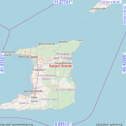
Sangre Grande GPS coordinates[2]
10° 35' 13.38" North, 61° 7' 48.288" West
| Map corner | latitude | longitude |
|---|---|---|
| Upper-left | 11.27741°, | -61.83321° |
| Center: | 10.58705°, | -61.13008° |
| Lower-right: | 9.89513°, | -60.42696° |
| Map W x H: | 153.7×153.7 km | = 95.5×95.5mi |
| max Lat: | 11.18229° ⇑45.5% North |
| Sangre Grande: | 10.58705° |
| min Lat: | ⇓54.5% South 10.14525° |
| min Long | Sangre Grande | max Long |
| -61.68407° | -61.13008° | -60.73525° |
| W 95.5%⇐ | ⇒4.5% E |
Elevation
Elevation of Sangre Grande is 17 m = 56 ft, and this is 19.9 m = 65 ft below average elevation for this country.
| Max E: |
100 m = 328 ft | 72.7% |
| Avg. | 36.9 m = 121 ft | |
| Sangre Grande | 17 m = 56 ft | |
Min E: |
3 m = 10 ft | 27.3% |
See also: Trinidad and Tobago elevation on elevation.city.
Geographical zone
Sangre Grande is located in North Torrid zone (between Equator and Tropic of Cancer). Distance of Equator is 1177.2 km =731.5 mi to South.| Distance of | km | miles | from Sangre Grande |
|---|---|---|---|
| North Pole | 8829.9 | 5486.6 | to North |
| Arctic Circle | 6224 | 3867.4 | to North |
| Tropic Cancer | 1428.7 | 887.8 | to North |
| Equator | 1177.2 | 731.5 | to South |


Nearby cities:
15 places around Sangre Grande: (largest is in red/bold)
• Arima
17.5 km =10.9 mi,  288°
288°
• Arouca
22.9 km =14.2 mi,  281°
281°
• Chaguanas
32.3 km =20.1 mi,  255°
255°
• Couva
41.2 km =25.6 mi,  243°
243°
• Laventille
40.9 km =25.4 mi, 279°
• Marabella
46.6 km =29 mi,  227°
227°
• Mon Repos
48.6 km =30.2 mi, 225°
• Mucurapo
45.3 km =28.1 mi, 280°
• Paradise
26.5 km =16.5 mi, 286°
• Petit Valley
47.3 km =29.4 mi, 285°
• Port of Spain
43.4 km =27 mi, 281°
• Princes Town
43.8 km =27.2 mi,  216°
216°
• Rio Claro
31.6 km =19.6 mi,  189°
189°
• Tabaquite
28.7 km =17.8 mi, 219°
• Tunapuna
29.2 km =18.1 mi, 284°
Sources, notices
• [Note1] Compared only with cities in Trinidad and Tobago existing in our database
• [Src1] Map data: © OpenStreetMap contributors (CC-BY-SA)
• [Src2] Other city data from geonames.org with taken over terms of usage.
• [Src3] Geographical zone / Annual Mean Temperature by Robert A. Rohde @ Wikipedia
