Daxi geodata
Daxi (Taiwan) is a populated place; located in Taiwan in Asia/Taipei (GMT+8) time zone. With population of 84,549 people, there are 15 cities with bigger population in this country. Compared to other cities in Taiwan, 78.4% of cities are located further ↓South; 75.7% of cities are located further ←West and 86.5% of cities have lower elevation than Daxi. Note1
Administrative division(s):
- Level 1: Taiwan
- Level 2: Taoyuan
- Level 3: Daxi District
- Level 4: Tianxin Village


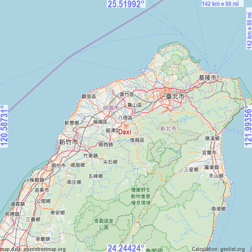
Daxi GPS coordinates[2]
24° 53' 1.428" North, 121° 17' 25.548" East
| Map corner | latitude | longitude |
|---|---|---|
| Upper-left | 25.51992°, | 120.58731° |
| Center: | 24.88373°, | 121.29043° |
| Lower-right: | 24.24424°, | 121.99356° |
| Map W x H: | 141.8×141.8 km | = 88.1×88.1mi |
| max Lat: | 26.15039° ⇑21.6% North |
| Daxi: | 24.88373° |
| min Lat: | ⇓78.4% South 22.00417° |
| min Long | Daxi | max Long |
| 118.31712° | 121.29043° | 121.84424° |
| W 75.7%⇐ | ⇒24.3% E |
Elevation
Elevation of Daxi is 125 m = 410 ft, and this is 46.5 m = 153 ft above average elevation for this country.
| Max E: |
505 m = 1657 ft | 13.5% |
| Daxi | 125 m 410 ft | |
| Avg. | 78.5 m = 258 ft | |
Min E: |
8 m = 26 ft | 86.5% |
See also: Daxi elevation on elevation.city.
Geographical zone
Daxi is located in North temperate zone (between Tropic of Cancer and the Arctic Circle). Distance of this Northern Tropic circle is 160.9 km =100 mi to South.| Distance of | km | miles | from Daxi |
|---|---|---|---|
| North Pole | 7240.3 | 4498.9 | to North |
| Arctic Circle | 4634.4 | 2879.7 | to North |
| Tropic Cancer | 160.9 | 100 | to South |
| Equator | 2766.8 | 1719.2 | to South |


Nearby cities:
15 places around Daxi: (largest is in red/bold)
• Banqiao
23 km =14.3 mi,  50°
50°
• Fengyuan
91.3 km =56.7 mi,  219°
219°
• Hsinchu
33.7 km =20.9 mi,  254°
254°
• Hualien City
105.7 km =65.7 mi,  162°
162°
• Jiufen
61.2 km =38 mi,  65°
65°
• Keelung
53 km =32.9 mi,  59°
59°
• Miaoli
59 km =36.7 mi,  233°
233°
• Puli
107 km =66.5 mi,  197°
197°
• Taichung
102.4 km =63.6 mi, 216°
• Taipei
30.4 km =18.9 mi, 53°
• Taoyuan
12.1 km =7.5 mi,  13°
13°
• Taoyuan City
12.2 km =7.6 mi,  3°
3°
• Xindian
26.5 km =16.5 mi, 71°
• Yilan
48.8 km =30.3 mi,  106°
106°
• Zhubei
29 km =18 mi,  259°
259°
In other languages:
- In Russian: Та-Си-чен
- In Chinese: Ta-ch’i-chen, Ta-ch’i, Ta-ch’i-chieh, Ta-k’o-k’an, 大溪
Sources, notices
• [Note1] Compared only with cities in Taiwan existing in our database
• [Src1] Map data: © OpenStreetMap contributors (CC-BY-SA)
• [Src2] Other city data from geonames.org with taken over terms of usage.
• [Src3] Geographical zone / Annual Mean Temperature by Robert A. Rohde @ Wikipedia
