Pizitou geodata
Pizitou (Taiwan) is a section of populated place; located in Taiwan in Asia/Taipei (GMT+8) time zone. With population of 5,000 people, there are 23 cities with bigger population in this country. Compared to other cities in Taiwan, 67.6% of cities are located further ↑North; 78.4% of cities are located further →East and 56.8% of cities have lower elevation than Pizitou. Note1
Administrative division(s):
- Level 1: Taiwan
- Level 2: Chiayi
- Level 3: W. District
- Level 4: Qing'an Village


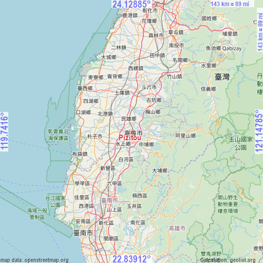
Pizitou GPS coordinates[2]
23° 29' 8.016" North, 120° 26' 40.992" East
| Map corner | latitude | longitude |
|---|---|---|
| Upper-left | 24.12885°, | 119.7416° |
| Center: | 23.48556°, | 120.44472° |
| Lower-right: | 22.83912°, | 121.14785° |
| Map W x H: | 143.4×143.4 km | = 89.1×89.1mi |
| max Lat: | 26.15039° ⇑67.6% North |
| Pizitou: | 23.48556° |
| min Lat: | ⇓32.4% South 22.00417° |
| min Long | Pizitou | max Long |
| 118.31712° | 120.44472° | 121.84424° |
| W 21.6%⇐ | ⇒78.4% E |
Elevation
Elevation of Pizitou is 38 m = 125 ft, and this is 40.5 m = 133 ft below average elevation for this country.
| Max E: |
505 m = 1657 ft | 43.2% |
| Avg. | 78.5 m = 258 ft | |
| Pizitou | 38 m = 125 ft | |
Min E: |
8 m = 26 ft | 56.8% |
See also: Taiwan elevation on elevation.city.
Geographical zone
Pizitou is located in North temperate zone (between Tropic of Cancer and the Arctic Circle). Distance of this Northern Tropic circle is 5.4 km =3.4 mi to South.| Distance of | km | miles | from Pizitou |
|---|---|---|---|
| North Pole | 7395.7 | 4595.5 | to North |
| Arctic Circle | 4789.8 | 2976.2 | to North |
| Tropic Cancer | 5.4 | 3.4 | to South |
| Equator | 2611.3 | 1622.6 | to South |


Nearby cities:
15 places around Pizitou: (largest is in red/bold)
• Chang-hua
66.4 km =41.3 mi,  10°
10°
• Douliu
26.8 km =16.7 mi,  21°
21°
• Fengyuan
89.4 km =55.6 mi, 18°
• Jiayi Shi
0.8 km =0.5 mi,  149°
149°
• Lugu
42.7 km =26.5 mi,  47°
47°
• Magong
88 km =54.7 mi,  275°
275°
• Nantou
52.8 km =32.8 mi,  25°
25°
• Puli
75.6 km =47 mi,  44°
44°
• Taibao
11.8 km =7.3 mi,  255°
255°
• Taichung
77.5 km =48.2 mi, 18°
• Tainan
59.9 km =37.2 mi,  203°
203°
• Xinying
24.1 km =15 mi,  214°
214°
• Yuanlin
54.1 km =33.6 mi, 14°
• Yujing
40.1 km =24.9 mi,  177°
177°
• Zhongxing New Village
58.1 km =36.1 mi, 24°
Sources, notices
• [Note1] Compared only with cities in Taiwan existing in our database
• [Src1] Map data: © OpenStreetMap contributors (CC-BY-SA)
• [Src2] Other city data from geonames.org with taken over terms of usage.
• [Src3] Geographical zone / Annual Mean Temperature by Robert A. Rohde @ Wikipedia
