Nizhniye Oreshniki geodata
Nizhniye Oreshniki (Republic of Crimea) is a populated place; located in Ukraine in Europe/Simferopol (GMT+3) time zone. With population of 581 people, there are 1602 cities with bigger population in this country. Compared to other cities in Ukraine, 90% of cities are located further ↑North; 69.5% of cities are located further ←West and 85.6% of cities have lower elevation than Nizhniye Oreshniki. Note1
Administrative division(s):
- Level 1: Republic of Crimea
- Level 2: Belogorskiy rayon
- Level 3: Zuyskoye sel'skoye poselenye


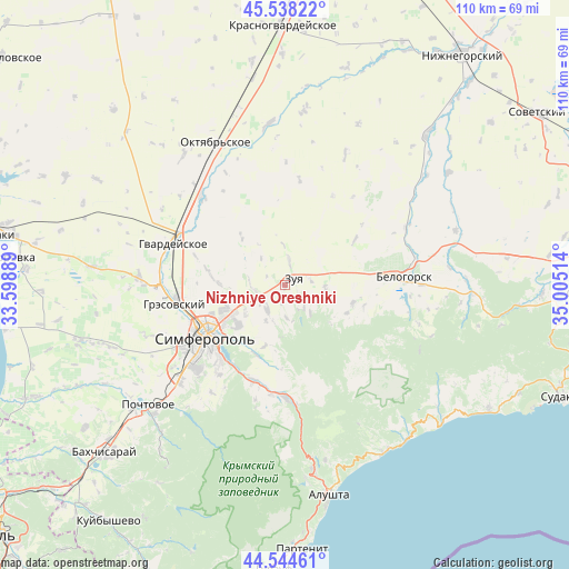
Nizhniye Oreshniki GPS coordinates[2]
45° 2' 36.852" North, 34° 18' 7.236" East
| Map corner | latitude | longitude |
|---|---|---|
| Upper-left | 45.53822°, | 33.59889° |
| Center: | 45.04357°, | 34.30201° |
| Lower-right: | 44.54461°, | 35.00514° |
| Map W x H: | 110.5×110.5 km | = 68.7×68.7mi |
| max Lat: | 52.18903° ⇑90% North |
| Nizhniye Oreshniki: | 45.04357° |
| min Lat: | ⇓10% South 44.39214° |
| min Long | Nizhniye Oreshn | max Long |
| 22.20555° | 34.30201° | 40.13222° |
| W 69.5%⇐ | ⇒30.5% E |
Elevation
Elevation of Nizhniye Oreshniki is 279 m = 915 ft, and this is 123.2 m = 404 ft above average elevation for this country.
| Max E: |
886 m = 2907 ft | 14.4% |
| Nizhniye Oreshniki | 279 m 915 ft | |
| Avg. | 155.8 m = 511 ft | |
Min E: |
-3 m = -10 ft | 85.6% |
See also: Ukraine elevation on elevation.city.
Geographical zone
Nizhniye Oreshniki is located in North temperate zone (between Tropic of Cancer and the Arctic Circle). Distance of this North polar circle is 2392.8 km =1486.8 mi to North.| Distance of | km | miles | from Nizhniye Oreshniki |
|---|---|---|---|
| North Pole | 4998.7 | 3106 | to North |
| Arctic Circle | 2392.8 | 1486.8 | to North |
| Tropic Cancer | 2402.5 | 1492.8 | to South |
| Equator | 5008.4 | 3112.1 | to South |


Nearby cities:
15 places around Nizhniye Oreshniki: (largest is in red/bold)
• Aromatnoye
7.7 km =4.8 mi,  95°
95°
• Aykavan
12.6 km =7.8 mi,  245°
245°
• Dolinovka
12.3 km =7.6 mi,  30°
30°
• Donskoye
6.9 km =4.3 mi,  271°
271°
• Ivanovka
12.4 km =7.7 mi,  198°
198°
• Klyonovka
12.3 km =7.6 mi,  316°
316°
• Krasnovka
8 km =5 mi,  208°
208°
• Krymskaya Roza
4.5 km =2.8 mi,  69°
69°
• Litvinenkovo
4.8 km =3 mi,  8°
8°
• Mazanka
5.6 km =3.5 mi,  220°
220°
• Trudovoye
9.7 km =6 mi,  233°
233°
• Tsvetochnoye
8.1 km =5 mi,  53°
53°
• Urozhaynoye
13.1 km =8.1 mi, 270°
• Verkhnekurgannoye
7.1 km =4.4 mi, 318°
• Zuya
1.9 km =1.2 mi, 52°
Sources, notices
• [Note1] Compared only with cities in Ukraine existing in our database
• [Src1] Map data: © OpenStreetMap contributors (CC-BY-SA)
• [Src2] Other city data from geonames.org with taken over terms of usage.
• [Src3] Geographical zone / Annual Mean Temperature by Robert A. Rohde @ Wikipedia
