Trudovoye geodata
Trudovoye (Republic of Crimea) is a seat of a third-order administrative division; located in Ukraine in Europe/Simferopol (GMT+3) time zone. With population of 2,173 people, there are 1081 cities with bigger population in this country. Compared to other cities in Ukraine, 91.6% of cities are located further ↑North; 67.6% of cities are located further ←West and 95.9% of cities have lower elevation than Trudovoye. Note1
Administrative division(s):
- Level 1: Republic of Crimea
- Level 2: Simferopol Raion
- Level 3: Trudovskoye sel'skoye poselenye


Trudovoye GPS coordinates[2]
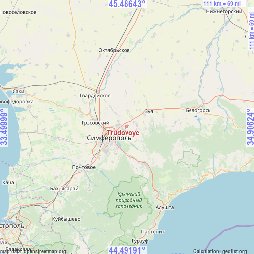
44° 59' 28.788" North, 34° 12' 11.196" East
| Map corner | latitude | longitude |
|---|---|---|
| Upper-left | 45.48643°, | 33.49999° |
| Center: | 44.99133°, | 34.20311° |
| Lower-right: | 44.49191°, | 34.90624° |
| Map W x H: | 110.6×110.6 km | = 68.7×68.7mi |
| max Lat: | 52.18903° ⇑91.6% North |
| Trudovoye: | 44.99133° |
| min Lat: | ⇓8.4% South 44.39214° |
| min Long | Trudovoye | max Long |
| 22.20555° | 34.20311° | 40.13222° |
| W 67.6%⇐ | ⇒32.4% E |
Elevation
Elevation of Trudovoye is 381 m = 1250 ft, and this is 225.2 m = 739 ft above average elevation for this country.
| Max E: |
886 m = 2907 ft | 4.1% |
| Trudovoye | 381 m 1250 ft | |
| Avg. | 155.8 m = 511 ft | |
Min E: |
-3 m = -10 ft | 95.9% |
See also: Ukraine elevation on elevation.city.
Geographical zone
Trudovoye is located in North temperate zone (between Tropic of Cancer and the Arctic Circle). Distance of this Northern Tropic circle is 2396.6 km =1489.2 mi to South.| Distance of | km | miles | from Trudovoye |
|---|---|---|---|
| North Pole | 5004.5 | 3109.7 | to North |
| Arctic Circle | 2398.6 | 1490.4 | to North |
| Tropic Cancer | 2396.6 | 1489.2 | to South |
| Equator | 5002.6 | 3108.5 | to South |


Nearby cities:
15 places around Trudovoye: (largest is in red/bold)
• Andrusovo
11.3 km =7 mi,  189°
189°
• Aykavan
3.8 km =2.4 mi,  279°
279°
• Denisovka
7.9 km =4.9 mi,  165°
165°
• Donskoye
6 km =3.7 mi,  8°
8°
• Ivanovka
7.1 km =4.4 mi,  146°
146°
• Krasnovka
4.1 km =2.5 mi,  107°
107°
• Lozovoye
10 km =6.2 mi,  197°
197°
• Mazanka
4.4 km =2.7 mi,  69°
69°
• Mirnoye
11.2 km =7 mi,  265°
265°
• Nizhniye Oreshniki
9.7 km =6 mi,  53°
53°
• Simferopol
8.2 km =5.1 mi,  242°
242°
• Solnechnoye
11.3 km =7 mi,  303°
303°
• Strogonovka
5 km =3.1 mi, 202°
• Urozhaynoye
8 km =5 mi,  318°
318°
• Verkhnekurgannoye
11.5 km =7.1 mi,  15°
15°
Sources, notices
• [Note1] Compared only with cities in Ukraine existing in our database
• [Src1] Map data: © OpenStreetMap contributors (CC-BY-SA)
• [Src2] Other city data from geonames.org with taken over terms of usage.
• [Src3] Geographical zone / Annual Mean Temperature by Robert A. Rohde @ Wikipedia
