Luganskoye geodata
Luganskoye (Republic of Crimea) is a seat of a third-order administrative division; located in Ukraine in Europe/Simferopol (GMT+3) time zone. With population of 1,129 people, there are 1321 cities with bigger population in this country. Compared to other cities in Ukraine, 71.8% of cities are located further ↑North; 68.3% of cities are located further ←West and 86.9% of cities have higher elevation than Luganskoye. Note1
Administrative division(s):
- Level 1: Republic of Crimea
- Level 2: Dzhankoyskiy rayon
- Level 3: Luganskoye sel'skoye poselenye


Luganskoye GPS coordinates[2]
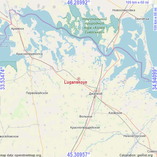
45° 48' 6.84" North, 34° 14' 16.296" East
| Map corner | latitude | longitude |
|---|---|---|
| Upper-left | 46.28992°, | 33.53474° |
| Center: | 45.8019°, | 34.23786° |
| Lower-right: | 45.30957°, | 34.94099° |
| Map W x H: | 109×109 km | = 67.7×67.7mi |
| max Lat: | 52.18903° ⇑71.8% North |
| Luganskoye: | 45.8019° |
| min Lat: | ⇓28.2% South 44.39214° |
| min Long | Luganskoye | max Long |
| 22.20555° | 34.23786° | 40.13222° |
| W 68.3%⇐ | ⇒31.7% E |
Elevation
Elevation of Luganskoye is 25 m = 82 ft, and this is 130.8 m = 429 ft below average elevation for this country.
| Max E: |
886 m = 2907 ft | 86.9% |
| Avg. | 155.8 m = 511 ft | |
| Luganskoye | 25 m = 82 ft | |
Min E: |
-3 m = -10 ft | 13.1% |
See also: Ukraine elevation on elevation.city.
Geographical zone
Luganskoye is located in North temperate zone (between Tropic of Cancer and the Arctic Circle). Distance of this North polar circle is 2308.5 km =1434.4 mi to North.| Distance of | km | miles | from Luganskoye |
|---|---|---|---|
| North Pole | 4914.4 | 3053.7 | to North |
| Arctic Circle | 2308.5 | 1434.4 | to North |
| Tropic Cancer | 2486.8 | 1545.2 | to South |
| Equator | 5092.7 | 3164.5 | to South |


Nearby cities:
15 places around Luganskoye: (largest is in red/bold)
• Dneprovka
13.8 km =8.6 mi,  135°
135°
• Kalinovka
9.5 km =5.9 mi,  129°
129°
• Komsomol’skoye
12.5 km =7.8 mi,  103°
103°
• Krymka
11.5 km =7.1 mi,  199°
199°
• Lobanovo
3 km =1.9 mi,  173°
173°
• Martynovka
10.6 km =6.6 mi,  42°
42°
• Mar’ino
8.4 km =5.2 mi,  163°
163°
• Maslovo
9.8 km =6.1 mi, 96°
• Mirnovka
13.5 km =8.4 mi, 155°
• Novokrymskoye
6.8 km =4.2 mi,  249°
249°
• Ovoshchnoye
9.3 km =5.8 mi,  123°
123°
• Pakharevka
7 km =4.3 mi,  301°
301°
• Tselinnoye
12.4 km =7.7 mi,  339°
339°
• Yarkoye
12.5 km =7.8 mi, 170°
• Zavet-Leninskiy
13.7 km =8.5 mi,  60°
60°
Sources, notices
• [Note1] Compared only with cities in Ukraine existing in our database
• [Src1] Map data: © OpenStreetMap contributors (CC-BY-SA)
• [Src2] Other city data from geonames.org with taken over terms of usage.
• [Src3] Geographical zone / Annual Mean Temperature by Robert A. Rohde @ Wikipedia
