Lyubotyn geodata
Lyubotyn (Kharkiv) is a populated place; located in Ukraine in Europe/Kiev (GMT+3) time zone. With population of 22,545 people, there are 182 cities with bigger population in this country. Compared to other cities in Ukraine, 82.6% of cities are located further ↓South; 86.7% of cities are located further ←West and 63.8% of cities have lower elevation than Lyubotyn. Note1


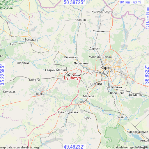
Lyubotyn GPS coordinates[2]
49° 56' 48.876" North, 35° 55' 44.652" East
| Map corner | latitude | longitude |
|---|---|---|
| Upper-left | 50.39725°, | 35.22595° |
| Center: | 49.94691°, | 35.92907° |
| Lower-right: | 49.49232°, | 36.6322° |
| Map W x H: | 100.6×100.6 km | = 62.5×62.5mi |
| max Lat: | 52.18903° ⇑17.4% North |
| Lyubotyn: | 49.94691° |
| min Lat: | ⇓82.6% South 44.39214° |
| min Long | Lyubotyn | max Long |
| 22.20555° | 35.92907° | 40.13222° |
| W 86.7%⇐ | ⇒13.3% E |
Elevation
Elevation of Lyubotyn is 182 m = 597 ft, and this is 26.2 m = 86 ft above average elevation for this country.
| Max E: |
886 m = 2907 ft | 36.2% |
| Lyubotyn | 182 m 597 ft | |
| Avg. | 155.8 m = 511 ft | |
Min E: |
-3 m = -10 ft | 63.8% |
See also: Ukraine elevation on elevation.city.
Geographical zone
Lyubotyn is located in North temperate zone (between Tropic of Cancer and the Arctic Circle). Distance of this North polar circle is 1847.6 km =1148 mi to North.| Distance of | km | miles | from Lyubotyn |
|---|---|---|---|
| North Pole | 4453.5 | 2767.3 | to North |
| Arctic Circle | 1847.6 | 1148 | to North |
| Tropic Cancer | 2947.7 | 1831.6 | to South |
| Equator | 5553.6 | 3450.8 | to South |


Nearby cities:
15 places around Lyubotyn: (largest is in red/bold)
• Budy
9 km =5.6 mi,  133°
133°
• Derhachi
22.4 km =13.9 mi,  37°
37°
• Khorosheve
23.1 km =14.4 mi,  116°
116°
• Korotych
7.7 km =4.8 mi,  89°
89°
• Mala Danylivka
21.3 km =13.2 mi,  52°
52°
• Manchenky
6.2 km =3.9 mi,  305°
305°
• Merefa
16.3 km =10.1 mi,  147°
147°
• Peresichna
9.3 km =5.8 mi,  22°
22°
• Pivdenne
12.2 km =7.6 mi, 125°
• Pokotylivka
18 km =11.2 mi,  101°
101°
• Shlyakh
12.1 km =7.5 mi,  258°
258°
• Solonytsivka
9.4 km =5.8 mi, 53°
• Staryy Merchyk
12.8 km =8 mi,  287°
287°
• Utkivka
20.8 km =12.9 mi, 149°
• Vysokyy
15.1 km =9.4 mi,  114°
114°
Sources, notices
• [Note1] Compared only with cities in Ukraine existing in our database
• [Src1] Map data: © OpenStreetMap contributors (CC-BY-SA)
• [Src2] Other city data from geonames.org with taken over terms of usage.
• [Src3] Geographical zone / Annual Mean Temperature by Robert A. Rohde @ Wikipedia
