Mala Danylivka geodata
Mala Danylivka (Kharkiv) is a populated place; located in Ukraine in Europe/Kiev (GMT+3) time zone. With population of 7,211 people, there are 495 cities with bigger population in this country. Compared to other cities in Ukraine, 84.6% of cities are located further ↓South; 87.9% of cities are located further ←West and 56.1% of cities have higher elevation than Mala Danylivka. Note1


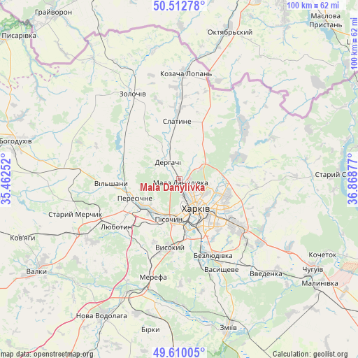
Mala Danylivka GPS coordinates[2]
50° 3' 48.744" North, 36° 9' 56.304" East
| Map corner | latitude | longitude |
|---|---|---|
| Upper-left | 50.51278°, | 35.46252° |
| Center: | 50.06354°, | 36.16564° |
| Lower-right: | 49.61005°, | 36.86877° |
| Map W x H: | 100.4×100.4 km | = 62.4×62.4mi |
| max Lat: | 52.18903° ⇑15.4% North |
| Mala Danylivka: | 50.06354° |
| min Lat: | ⇓84.6% South 44.39214° |
| min Long | Mala Danylivka | max Long |
| 22.20555° | 36.16564° | 40.13222° |
| W 87.9%⇐ | ⇒12.1% E |
Elevation
Elevation of Mala Danylivka is 117 m = 384 ft, and this is 38.8 m = 127 ft below average elevation for this country.
| Max E: |
886 m = 2907 ft | 56.1% |
| Avg. | 155.8 m = 511 ft | |
| Mala Danylivka | 117 m = 384 ft | |
Min E: |
-3 m = -10 ft | 43.9% |
See also: Ukraine elevation on elevation.city.
Geographical zone
Mala Danylivka is located in North temperate zone (between Tropic of Cancer and the Arctic Circle). Distance of this North polar circle is 1834.6 km =1140 mi to North.| Distance of | km | miles | from Mala Danylivka |
|---|---|---|---|
| North Pole | 4440.5 | 2759.2 | to North |
| Arctic Circle | 1834.6 | 1140 | to North |
| Tropic Cancer | 2960.6 | 1839.6 | to South |
| Equator | 5566.5 | 3458.9 | to South |


Nearby cities:
15 places around Mala Danylivka: (largest is in red/bold)
• Bezlyudivka
22.1 km =13.7 mi,  161°
161°
• Budy
21.8 km =13.5 mi,  208°
208°
• Derhachi
5.7 km =3.5 mi,  326°
326°
• Kharkiv
11.1 km =6.9 mi,  145°
145°
• Khorosheve
23.6 km =14.7 mi,  171°
171°
• Korotych
15.8 km =9.8 mi,  215°
215°
• Kulynychi
18 km =11.2 mi,  120°
120°
• Lyubotyn
21.3 km =13.2 mi,  232°
232°
• Peresichna
14 km =8.7 mi,  251°
251°
• Pivdenne
21.2 km =13.2 mi,  199°
199°
• Pokotylivka
16.7 km =10.4 mi,  177°
177°
• Prudyanka
19.2 km =11.9 mi,  0°
0°
• Slatyne
16.4 km =10.2 mi,  357°
357°
• Solonytsivka
11.9 km =7.4 mi, 231°
• Vysokyy
19.4 km =12.1 mi,  189°
189°
Sources, notices
• [Note1] Compared only with cities in Ukraine existing in our database
• [Src1] Map data: © OpenStreetMap contributors (CC-BY-SA)
• [Src2] Other city data from geonames.org with taken over terms of usage.
• [Src3] Geographical zone / Annual Mean Temperature by Robert A. Rohde @ Wikipedia
