Kerch geodata
Kerch (Republic of Crimea) is a seat of a second-order administrative division; located in Ukraine in Europe/Simferopol (GMT+3) time zone. With population of 148,932 people, there are 34 cities with bigger population in this country. Compared to other cities in Ukraine, 81.3% of cities are located further ↑North; 89.6% of cities are located further ←West and 98.6% of cities have higher elevation than Kerch. Note1


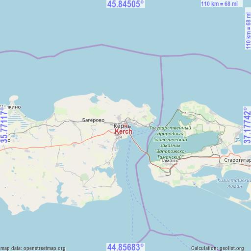
Kerch GPS coordinates[2]
45° 21' 11.16" North, 36° 28' 27.444" East
| Map corner | latitude | longitude |
|---|---|---|
| Upper-left | 45.84505°, | 35.77117° |
| Center: | 45.3531°, | 36.47429° |
| Lower-right: | 44.85683°, | 37.17742° |
| Map W x H: | 109.9×109.9 km | = 68.3×68.3mi |
| max Lat: | 52.18903° ⇑81.3% North |
| Kerch: | 45.3531° |
| min Lat: | ⇓18.7% South 44.39214° |
| min Long | Kerch | max Long |
| 22.20555° | 36.47429° | 40.13222° |
| W 89.6%⇐ | ⇒10.4% E |
Elevation
Elevation of Kerch is 6 m = 20 ft, and this is 149.8 m = 491 ft below average elevation for this country.
| Max E: |
886 m = 2907 ft | 98.6% |
| Avg. | 155.8 m = 511 ft | |
| Kerch | 6 m = 20 ft | |
Min E: |
-3 m = -10 ft | 1.4% |
See also: Kerch elevation on elevation.city.
Geographical zone
Kerch is located in North temperate zone (between Tropic of Cancer and the Arctic Circle). Distance of this North polar circle is 2358.4 km =1465.4 mi to North.| Distance of | km | miles | from Kerch |
|---|---|---|---|
| North Pole | 4964.3 | 3084.7 | to North |
| Arctic Circle | 2358.4 | 1465.4 | to North |
| Tropic Cancer | 2436.9 | 1514.2 | to South |
| Equator | 5042.8 | 3133.4 | to South |


Nearby cities:
15 places around Kerch: (largest is in red/bold)
• Baherove
14 km =8.7 mi,  279°
279°
• Belinskoye
30.7 km =19.1 mi,  274°
274°
• Bondarenkovo
5.3 km =3.3 mi,  11°
11°
• Chelyadinovo
17.9 km =11.1 mi,  205°
205°
• Chistopolye
22.8 km =14.2 mi, 273°
• Glazovka
9.1 km =5.7 mi,  64°
64°
• Gornostayevka
24 km =14.9 mi,  249°
249°
• Marfovka
34.5 km =21.4 mi,  240°
240°
• Maryevka
32.4 km =20.1 mi, 214°
• Novonikolayevka
33 km =20.5 mi,  261°
261°
• Oktyabr'skoye
8.4 km =5.2 mi, 276°
• Ostanino
44 km =27.3 mi, 266°
• Priozyornoye
14.3 km =8.9 mi,  229°
229°
• Voykovo
4.4 km =2.7 mi,  319°
319°
• Zavetnoye
26.2 km =16.3 mi,  192°
192°
In other languages:
- In France: Kertch
- In German: Kertsch
- In Italian: Kerč'
- In Russian: Керчь
- In Chinese: 刻赤
Sources, notices
• [Note1] Compared only with cities in Ukraine existing in our database
• [Src1] Map data: © OpenStreetMap contributors (CC-BY-SA)
• [Src2] Other city data from geonames.org with taken over terms of usage.
• [Src3] Geographical zone / Annual Mean Temperature by Robert A. Rohde @ Wikipedia
