Godovytsya geodata
Godovytsya (Lviv) is a populated place; located in Ukraine in Europe/Kiev (GMT+3) time zone. With population of 877 people, there are 1447 cities with bigger population in this country. Compared to other cities in Ukraine, 78.9% of cities are located further ↓South; 93% of cities are located further →East and 87.6% of cities have lower elevation than Godovytsya. Note1


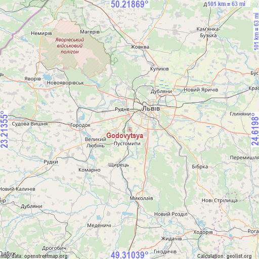
Godovytsya GPS coordinates[2]
49° 46' 0.012" North, 23° 55' 0.012" East
| Map corner | latitude | longitude |
|---|---|---|
| Upper-left | 50.21869°, | 23.21355° |
| Center: | 49.76667°, | 23.91667° |
| Lower-right: | 49.31039°, | 24.6198° |
| Map W x H: | 101×101 km | = 62.8×62.8mi |
| max Lat: | 52.18903° ⇑21.1% North |
| Godovytsya: | 49.76667° |
| min Lat: | ⇓78.9% South 44.39214° |
| min Long | Godovytsya | max Long |
| 22.20555° | 23.91667° | 40.13222° |
| W 7%⇐ | ⇒93% E |
Elevation
Elevation of Godovytsya is 291 m = 955 ft, and this is 135.2 m = 444 ft above average elevation for this country.
| Max E: |
886 m = 2907 ft | 12.4% |
| Godovytsya | 291 m 955 ft | |
| Avg. | 155.8 m = 511 ft | |
Min E: |
-3 m = -10 ft | 87.6% |
See also: Ukraine elevation on elevation.city.
Geographical zone
Godovytsya is located in North temperate zone (between Tropic of Cancer and the Arctic Circle). Distance of this North polar circle is 1867.6 km =1160.5 mi to North.| Distance of | km | miles | from Godovytsya |
|---|---|---|---|
| North Pole | 4473.5 | 2779.7 | to North |
| Arctic Circle | 1867.6 | 1160.5 | to North |
| Tropic Cancer | 2927.6 | 1819.1 | to South |
| Equator | 5533.5 | 3438.4 | to South |


Nearby cities:
15 places around Godovytsya: (largest is in red/bold)
• Bryukhovychi
15.7 km =9.8 mi,  11°
11°
• Dublyany
19.5 km =12.1 mi,  38°
38°
• Horbachi
19.1 km =11.9 mi,  181°
181°
• Horodok
19.4 km =12.1 mi,  275°
275°
• Ivano-Frankove
21.7 km =13.5 mi,  321°
321°
• Komarno
22 km =13.7 mi,  225°
225°
• Lviv
11 km =6.8 mi, 43°
• Navaria
2.1 km =1.3 mi,  157°
157°
• Obroshyne
4 km =2.5 mi,  297°
297°
• Pustomyty
5.7 km =3.5 mi, 182°
• Rudne
7.5 km =4.7 mi,  350°
350°
• Shchyrets
13.2 km =8.2 mi,  193°
193°
• Solonka
6.8 km =4.2 mi,  99°
99°
• Staroye Selo
20.6 km =12.8 mi,  107°
107°
• Sukhovolya
8.6 km =5.3 mi, 318°
Sources, notices
• [Note1] Compared only with cities in Ukraine existing in our database
• [Src1] Map data: © OpenStreetMap contributors (CC-BY-SA)
• [Src2] Other city data from geonames.org with taken over terms of usage.
• [Src3] Geographical zone / Annual Mean Temperature by Robert A. Rohde @ Wikipedia
