Rudne geodata
Rudne (Lviv) is a populated place; located in Ukraine in Europe/Kiev (GMT+3) time zone. With population of 6,016 people, there are 567 cities with bigger population in this country. Compared to other cities in Ukraine, 80.3% of cities are located further ↓South; 93.3% of cities are located further →East and 90.5% of cities have lower elevation than Rudne. Note1


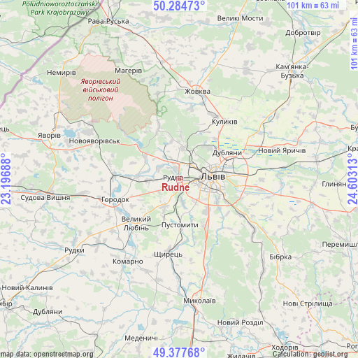
Rudne GPS coordinates[2]
49° 49' 59.988" North, 23° 54' 0" East
| Map corner | latitude | longitude |
|---|---|---|
| Upper-left | 50.28473°, | 23.19688° |
| Center: | 49.83333°, | 23.9° |
| Lower-right: | 49.37768°, | 24.60313° |
| Map W x H: | 100.9×100.9 km | = 62.7×62.7mi |
| max Lat: | 52.18903° ⇑19.7% North |
| Rudne: | 49.83333° |
| min Lat: | ⇓80.3% South 44.39214° |
| min Long | Rudne | max Long |
| 22.20555° | 23.9° | 40.13222° |
| W 6.7%⇐ | ⇒93.3% E |
Elevation
Elevation of Rudne is 311 m = 1020 ft, and this is 155.2 m = 509 ft above average elevation for this country.
| Max E: |
886 m = 2907 ft | 9.5% |
| Rudne | 311 m 1020 ft | |
| Avg. | 155.8 m = 511 ft | |
Min E: |
-3 m = -10 ft | 90.5% |
See also: Ukraine elevation on elevation.city.
Geographical zone
Rudne is located in North temperate zone (between Tropic of Cancer and the Arctic Circle). Distance of this North polar circle is 1860.2 km =1155.9 mi to North.| Distance of | km | miles | from Rudne |
|---|---|---|---|
| North Pole | 4466.1 | 2775.1 | to North |
| Arctic Circle | 1860.2 | 1155.9 | to North |
| Tropic Cancer | 2935 | 1823.7 | to South |
| Equator | 5540.9 | 3443 | to South |


Nearby cities:
15 places around Rudne: (largest is in red/bold)
• Bryukhovychi
9 km =5.6 mi,  28°
28°
• Dublyany
15.5 km =9.6 mi,  59°
59°
• Godovytsya
7.5 km =4.7 mi,  170°
170°
• Horodok
18.9 km =11.7 mi,  253°
253°
• Ivano-Frankove
15.6 km =9.7 mi,  308°
308°
• Krekhiv
25 km =15.5 mi,  346°
346°
• Kulykiv
20.7 km =12.9 mi,  38°
38°
• Lviv
8.9 km =5.5 mi,  86°
86°
• Navaria
9.5 km =5.9 mi, 168°
• Obroshyne
6.1 km =3.8 mi,  203°
203°
• Pustomyty
13.2 km =8.2 mi,  175°
175°
• Shchyrets
20.4 km =12.7 mi,  185°
185°
• Solonka
11.7 km =7.3 mi,  137°
137°
• Staroye Selo
24.9 km =15.5 mi,  123°
123°
• Sukhovolya
4.6 km =2.9 mi,  257°
257°
Sources, notices
• [Note1] Compared only with cities in Ukraine existing in our database
• [Src1] Map data: © OpenStreetMap contributors (CC-BY-SA)
• [Src2] Other city data from geonames.org with taken over terms of usage.
• [Src3] Geographical zone / Annual Mean Temperature by Robert A. Rohde @ Wikipedia
