Bystrytsya geodata
Bystrytsya (Ivano-Frankivsk) is a populated place; located in Ukraine in Europe/Kiev (GMT+3) time zone. With population of 1,016 people, there are 1369 cities with bigger population in this country. Compared to other cities in Ukraine, 54.5% of cities are located further ↓South; 91.3% of cities are located further →East and 99.7% of cities have lower elevation than Bystrytsya. Note1


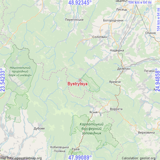
Bystrytsya GPS coordinates[2]
48° 27' 33.516" North, 24° 14' 43.62" East
| Map corner | latitude | longitude |
|---|---|---|
| Upper-left | 48.92345°, | 23.54233° |
| Center: | 48.45931°, | 24.24545° |
| Lower-right: | 47.99089°, | 24.94858° |
| Map W x H: | 103.7×103.7 km | = 64.4×64.4mi |
| max Lat: | 52.18903° ⇑45.5% North |
| Bystrytsya: | 48.45931° |
| min Lat: | ⇓54.5% South 44.39214° |
| min Long | Bystrytsya | max Long |
| 22.20555° | 24.24545° | 40.13222° |
| W 8.7%⇐ | ⇒91.3% E |
Elevation
Elevation of Bystrytsya is 742 m = 2434 ft, and this is 586.2 m = 1923 ft above average elevation for this country.
| Max E: |
886 m = 2907 ft | 0.3% |
| Bystrytsya | 742 m 2434 ft | |
| Avg. | 155.8 m = 511 ft | |
Min E: |
-3 m = -10 ft | 99.7% |
See also: Ukraine elevation on elevation.city.
Geographical zone
Bystrytsya is located in North temperate zone (between Tropic of Cancer and the Arctic Circle). Distance of this North polar circle is 2013 km =1250.8 mi to North.| Distance of | km | miles | from Bystrytsya |
|---|---|---|---|
| North Pole | 4618.9 | 2870.1 | to North |
| Arctic Circle | 2013 | 1250.8 | to North |
| Tropic Cancer | 2782.3 | 1728.8 | to South |
| Equator | 5388.2 | 3348.1 | to South |


Nearby cities:
15 places around Bystrytsya: (largest is in red/bold)
• Bytkiv
25.3 km =15.7 mi,  41°
41°
• Delyatyn
28.8 km =17.9 mi,  75°
75°
• Lazeshchyna
24.8 km =15.4 mi,  148°
148°
• Lopukhiv
23.3 km =14.5 mi,  243°
243°
• Manyava
23.8 km =14.8 mi,  23°
23°
• Markova
27.1 km =16.8 mi,  27°
27°
• Palyanytsya
18.8 km =11.7 mi,  130°
130°
• Pasichna
18.5 km =11.5 mi,  47°
47°
• Pniv
27.3 km =17 mi, 49°
• Porohy
25.4 km =15.8 mi,  2°
2°
• Solotvyn
30 km =18.6 mi, 25°
• Tatariv
27.6 km =17.1 mi,  117°
117°
• Yablunytsya
23.7 km =14.7 mi, 131°
• Yaremche
22.8 km =14.2 mi,  92°
92°
• Yasinya
21.7 km =13.5 mi,  157°
157°
Sources, notices
• [Note1] Compared only with cities in Ukraine existing in our database
• [Src1] Map data: © OpenStreetMap contributors (CC-BY-SA)
• [Src2] Other city data from geonames.org with taken over terms of usage.
• [Src3] Geographical zone / Annual Mean Temperature by Robert A. Rohde @ Wikipedia
