Porohy geodata
Porohy (Ivano-Frankivsk) is a populated place; located in Ukraine in Europe/Kiev (GMT+3) time zone. With population of 3,004 people, there are 942 cities with bigger population in this country. Compared to other cities in Ukraine, 60.3% of cities are located further ↓South; 91.1% of cities are located further →East and 98.7% of cities have lower elevation than Porohy. Note1


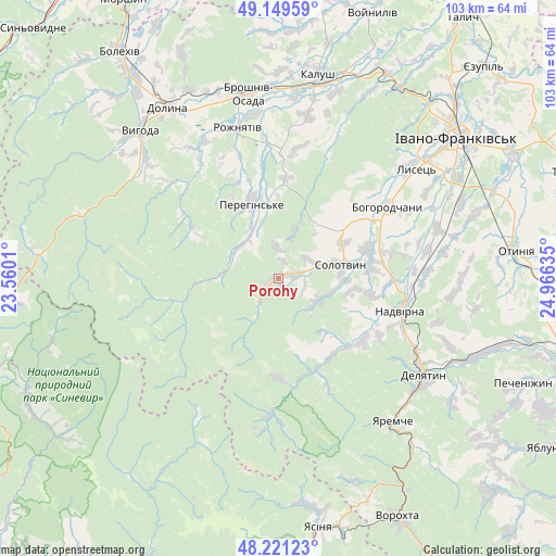
Porohy GPS coordinates[2]
48° 41' 15.18" North, 24° 15' 47.592" East
| Map corner | latitude | longitude |
|---|---|---|
| Upper-left | 49.14959°, | 23.5601° |
| Center: | 48.68755°, | 24.26322° |
| Lower-right: | 48.22123°, | 24.96635° |
| Map W x H: | 103.2×103.2 km | = 64.1×64.1mi |
| max Lat: | 52.18903° ⇑39.7% North |
| Porohy: | 48.68755° |
| min Lat: | ⇓60.3% South 44.39214° |
| min Long | Porohy | max Long |
| 22.20555° | 24.26322° | 40.13222° |
| W 8.9%⇐ | ⇒91.1% E |
Elevation
Elevation of Porohy is 548 m = 1798 ft, and this is 392.2 m = 1287 ft above average elevation for this country.
| Max E: |
886 m = 2907 ft | 1.3% |
| Porohy | 548 m 1798 ft | |
| Avg. | 155.8 m = 511 ft | |
Min E: |
-3 m = -10 ft | 98.7% |
See also: Ukraine elevation on elevation.city.
Geographical zone
Porohy is located in North temperate zone (between Tropic of Cancer and the Arctic Circle). Distance of this North polar circle is 1987.6 km =1235 mi to North.| Distance of | km | miles | from Porohy |
|---|---|---|---|
| North Pole | 4593.5 | 2854.3 | to North |
| Arctic Circle | 1987.6 | 1235 | to North |
| Tropic Cancer | 2807.6 | 1744.6 | to South |
| Equator | 5413.5 | 3363.8 | to South |


Nearby cities:
15 places around Porohy: (largest is in red/bold)
• Bohorodchany
24.2 km =15 mi,  56°
56°
• Bystrytsya
25.4 km =15.8 mi,  182°
182°
• Bytkiv
16.8 km =10.4 mi,  112°
112°
• Hvizd
21.1 km =13.1 mi,  90°
90°
• Kosmach
10.4 km =6.5 mi,  47°
47°
• Manyava
9 km =5.6 mi, 113°
• Markova
11.1 km =6.9 mi,  96°
96°
• Nadvirna
23.2 km =14.4 mi, 104°
• Nebyliv
14.6 km =9.1 mi,  346°
346°
• Pasichna
17.8 km =11.1 mi,  136°
136°
• Petranka
24.1 km =15 mi,  7°
7°
• Pniv
21 km =13 mi, 111°
• Solotvyn
11.8 km =7.3 mi,  82°
82°
• Spas
26.9 km =16.7 mi,  326°
326°
• Stari Bohorodchany
25.1 km =15.6 mi, 49°
Sources, notices
• [Note1] Compared only with cities in Ukraine existing in our database
• [Src1] Map data: © OpenStreetMap contributors (CC-BY-SA)
• [Src2] Other city data from geonames.org with taken over terms of usage.
• [Src3] Geographical zone / Annual Mean Temperature by Robert A. Rohde @ Wikipedia
