Slocomb geodata
Slocomb (Alabama) is a populated place; located in United States in America/Chicago (GMT-5) time zone. With population of 1,972 people, there are 12023 cities with bigger population in this country. Compared to other cities in United States, 90.5% of cities are located further ↑North; 54.3% of cities are located further ←West and 71.5% of cities have higher elevation than Slocomb. Note1


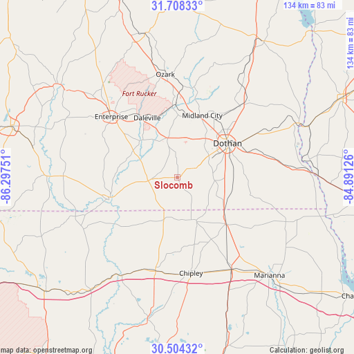
Slocomb GPS coordinates[2]
31° 6' 29.628" North, 85° 35' 39.768" West
| Map corner | latitude | longitude |
|---|---|---|
| Upper-left | 31.70833°, | -86.29751° |
| Center: | 31.10823°, | -85.59438° |
| Lower-right: | 30.50432°, | -84.89126° |
| Map W x H: | 133.9×133.9 km | = 83.2×83.2mi |
| max Lat: | 71.29058° ⇑90.5% North |
| Slocomb: | 31.10823° |
| min Lat: | ⇓9.5% South 19.06759° |
| min Long | Slocomb | max Long |
| -171.73463° | -85.59438° | -66.98998° |
| W 54.3%⇐ | ⇒45.7% E |
Elevation
Elevation of Slocomb is 92 m = 302 ft, and this is 202.8 m = 665 ft below average elevation for this country.
| Max E: |
3189 m = 10463 ft | 71.5% |
| Avg. | 294.8 m = 967 ft | |
| Slocomb | 92 m = 302 ft | |
Min E: |
-60 m = -197 ft | 28.5% |
See also: United States elevation on elevation.city.
Geographical zone
Slocomb is located in North temperate zone (between Tropic of Cancer and the Arctic Circle). Distance of this Northern Tropic circle is 853 km =530 mi to South.| Distance of | km | miles | from Slocomb |
|---|---|---|---|
| North Pole | 6548.2 | 4068.9 | to North |
| Arctic Circle | 3942.3 | 2449.6 | to North |
| Tropic Cancer | 853 | 530 | to South |
| Equator | 3458.9 | 2149.3 | to South |


Nearby cities:
15 places around Slocomb: (largest is in red/bold)
• Clayhatchee
18.7 km =11.6 mi,  319°
319°
• Cottonwood
28.3 km =17.6 mi,  103°
103°
• Daleville
25.1 km =15.6 mi,  333°
333°
• Dothan
23.2 km =14.4 mi,  56°
56°
• Geneva
27 km =16.8 mi,  251°
251°
• Graceville
18.4 km =11.4 mi,  156°
156°
• Grimes
25.9 km =16.1 mi,  32°
32°
• Hartford
9.8 km =6.1 mi,  266°
266°
• Level Plains
27.5 km =17.1 mi, 320°
• Malvern
8 km =5 mi, 64°
• Midland City
25.3 km =15.7 mi,  22°
22°
• Newton
25.3 km =15.7 mi,  357°
357°
• Pinckard
22.9 km =14.2 mi,  9°
9°
• Rehobeth
13.6 km =8.5 mi,  83°
83°
• Taylor
13.6 km =8.5 mi, 62°
Sources, notices
• [Note1] Compared only with cities in United States existing in our database
• [Src1] Map data: © OpenStreetMap contributors (CC-BY-SA)
• [Src2] Other city data from geonames.org with taken over terms of usage.
• [Src3] Geographical zone / Annual Mean Temperature by Robert A. Rohde @ Wikipedia
