Ashdown geodata
Ashdown (Arkansas) is a seat of a second-order administrative division; located in United States in America/Chicago (GMT-5) time zone. With population of 4,479 people, there are 7665 cities with bigger population in this country. Compared to other cities in United States, 82.2% of cities are located further ↑North; 68.9% of cities are located further →East and 69.6% of cities have higher elevation than Ashdown. Note1
Administrative division(s):
- Level 1: Arkansas
- Level 2: Little River County
- Level 3: Township of Jefferson


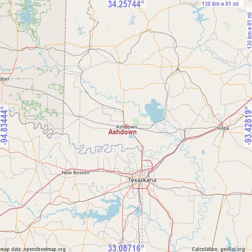
Ashdown GPS coordinates[2]
33° 40' 27.444" North, 94° 7' 52.716" West
| Map corner | latitude | longitude |
|---|---|---|
| Upper-left | 34.25744°, | -94.83444° |
| Center: | 33.67429°, | -94.13131° |
| Lower-right: | 33.08716°, | -93.42819° |
| Map W x H: | 130.1×130.1 km | = 80.8×80.8mi |
| max Lat: | 71.29058° ⇑82.2% North |
| Ashdown: | 33.67429° |
| min Lat: | ⇓17.8% South 19.06759° |
| min Long | Ashdown | max Long |
| -171.73463° | -94.13131° | -66.98998° |
| W 31.1%⇐ | ⇒68.9% E |
Elevation
Elevation of Ashdown is 103 m = 338 ft, and this is 191.8 m = 629 ft below average elevation for this country.
| Max E: |
3189 m = 10463 ft | 69.6% |
| Avg. | 294.8 m = 967 ft | |
| Ashdown | 103 m = 338 ft | |
Min E: |
-60 m = -197 ft | 30.4% |
See also: United States elevation on elevation.city.
Geographical zone
Ashdown is located in North temperate zone (between Tropic of Cancer and the Arctic Circle). Distance of this Northern Tropic circle is 1138.3 km =707.3 mi to South.| Distance of | km | miles | from Ashdown |
|---|---|---|---|
| North Pole | 6262.8 | 3891.5 | to North |
| Arctic Circle | 3656.9 | 2272.3 | to North |
| Tropic Cancer | 1138.3 | 707.3 | to South |
| Equator | 3744.2 | 2326.5 | to South |


Nearby cities:
15 places around Ashdown: (largest is in red/bold)
• De Queen
44.8 km =27.8 mi,  334°
334°
• Foreman
25.1 km =15.6 mi,  282°
282°
• Hooks
27.3 km =17 mi,  212°
212°
• Horatio
36 km =22.4 mi,  324°
324°
• Lockesburg
32.8 km =20.4 mi,  353°
353°
• Maud
42.7 km =26.5 mi, 207°
• Mineral Springs
30 km =18.6 mi,  41°
41°
• Nash
25.8 km =16 mi,  179°
179°
• Nashville
40 km =24.9 mi, 41°
• New Boston
35.5 km =22.1 mi,  227°
227°
• Red Lick
23.6 km =14.7 mi,  188°
188°
• Redwater
37 km =23 mi,  197°
197°
• Texarkana
27.3 km =17 mi,  161°
161°
• Texarkana
28.8 km =17.9 mi, 164°
• Wake Village
27.6 km =17.1 mi, 175°
Sources, notices
• [Note1] Compared only with cities in United States existing in our database
• [Src1] Map data: © OpenStreetMap contributors (CC-BY-SA)
• [Src2] Other city data from geonames.org with taken over terms of usage.
• [Src3] Geographical zone / Annual Mean Temperature by Robert A. Rohde @ Wikipedia
