Texarkana geodata
Texarkana (Arkansas) is a seat of a second-order administrative division; located in United States in America/Chicago (GMT-5) time zone. With population of 30,353 people, there are 1650 cities with bigger population in this country. Compared to other cities in United States, 83.4% of cities are located further ↑North; 68.7% of cities are located further →East and 66.9% of cities have higher elevation than Texarkana. Note1


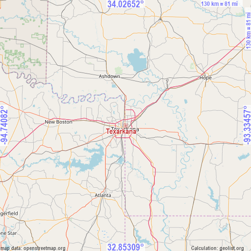
Texarkana GPS coordinates[2]
33° 26' 30.444" North, 94° 2' 15.684" West
| Map corner | latitude | longitude |
|---|---|---|
| Upper-left | 34.02652°, | -94.74082° |
| Center: | 33.44179°, | -94.03769° |
| Lower-right: | 32.85309°, | -93.33457° |
| Map W x H: | 130.5×130.5 km | = 81.1×81.1mi |
| max Lat: | 71.29058° ⇑83.4% North |
| Texarkana: | 33.44179° |
| min Lat: | ⇓16.6% South 19.06759° |
| min Long | Texarkana | max Long |
| -171.73463° | -94.03769° | -66.98998° |
| W 31.3%⇐ | ⇒68.7% E |
Elevation
Elevation of Texarkana is 118 m = 387 ft, and this is 176.8 m = 580 ft below average elevation for this country.
| Max E: |
3189 m = 10463 ft | 66.9% |
| Avg. | 294.8 m = 967 ft | |
| Texarkana | 118 m = 387 ft | |
Min E: |
-60 m = -197 ft | 33.1% |
See also: United States elevation on elevation.city.
Geographical zone
Texarkana is located in North temperate zone (between Tropic of Cancer and the Arctic Circle). Distance of this Northern Tropic circle is 1112.5 km =691.3 mi to South.| Distance of | km | miles | from Texarkana |
|---|---|---|---|
| North Pole | 6288.7 | 3907.6 | to North |
| Arctic Circle | 3682.8 | 2288.4 | to North |
| Tropic Cancer | 1112.5 | 691.3 | to South |
| Equator | 3718.4 | 2310.5 | to South |


Nearby cities:
15 places around Texarkana: (largest is in red/bold)
• Ashdown
27.3 km =17 mi,  341°
341°
• Atlanta
38.3 km =23.8 mi,  197°
197°
• Foreman
45.6 km =28.3 mi,  313°
313°
• Fouke
24.6 km =15.3 mi,  144°
144°
• Hooks
23.4 km =14.5 mi,  276°
276°
• Hope
48.3 km =30 mi,  58°
58°
• Lewisville
43.7 km =27.2 mi,  102°
102°
• Maud
30.8 km =19.1 mi,  246°
246°
• Nash
8.6 km =5.3 mi,  270°
270°
• New Boston
35.1 km =21.8 mi, 273°
• Queen City
34.2 km =21.3 mi, 197°
• Red Lick
12.6 km =7.8 mi, 281°
• Redwater
22.2 km =13.8 mi, 245°
• Texarkana
2.1 km =1.3 mi,  206°
206°
• Wake Village
6.6 km =4.1 mi,  255°
255°
Sources, notices
• [Note1] Compared only with cities in United States existing in our database
• [Src1] Map data: © OpenStreetMap contributors (CC-BY-SA)
• [Src2] Other city data from geonames.org with taken over terms of usage.
• [Src3] Geographical zone / Annual Mean Temperature by Robert A. Rohde @ Wikipedia
