Blytheville geodata
Blytheville (Arkansas) is a populated place; located in United States in America/Chicago (GMT-5) time zone. With population of 14,694 people, there are 3297 cities with bigger population in this country. Compared to other cities in United States, 70.8% of cities are located further ↑North; 58.8% of cities are located further →East and 74% of cities have higher elevation than Blytheville. Note1
Administrative division(s):
- Level 1: Arkansas
- Level 2: Mississippi County
- Level 3: Township of Chickasawba


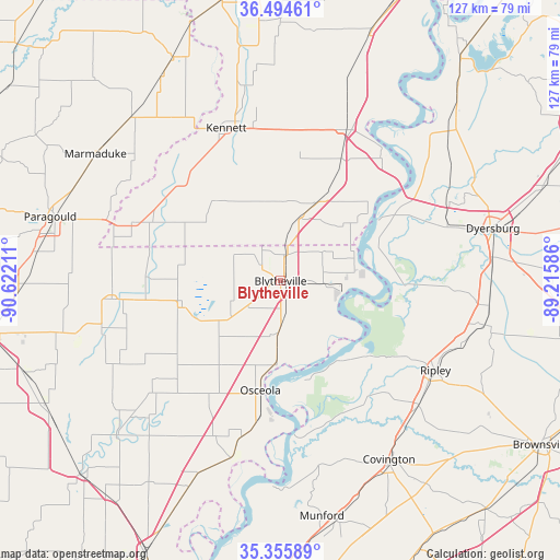
Blytheville GPS coordinates[2]
35° 55' 38.28" North, 89° 55' 8.328" West
| Map corner | latitude | longitude |
|---|---|---|
| Upper-left | 36.49461°, | -90.62211° |
| Center: | 35.9273°, | -89.91898° |
| Lower-right: | 35.35589°, | -89.21586° |
| Map W x H: | 126.6×126.6 km | = 78.7×78.7mi |
| max Lat: | 71.29058° ⇑70.8% North |
| Blytheville: | 35.9273° |
| min Lat: | ⇓29.2% South 19.06759° |
| min Long | Blytheville | max Long |
| -171.73463° | -89.91898° | -66.98998° |
| W 41.2%⇐ | ⇒58.8% E |
Elevation
Elevation of Blytheville is 77 m = 253 ft, and this is 217.8 m = 715 ft below average elevation for this country.
| Max E: |
3189 m = 10463 ft | 74% |
| Avg. | 294.8 m = 967 ft | |
| Blytheville | 77 m = 253 ft | |
Min E: |
-60 m = -197 ft | 26% |
See also: United States elevation on elevation.city.
Geographical zone
Blytheville is located in North temperate zone (between Tropic of Cancer and the Arctic Circle). Distance of this Northern Tropic circle is 1388.8 km =863 mi to South.| Distance of | km | miles | from Blytheville |
|---|---|---|---|
| North Pole | 6012.3 | 3735.9 | to North |
| Arctic Circle | 3406.4 | 2116.6 | to North |
| Tropic Cancer | 1388.8 | 863 | to South |
| Equator | 3994.7 | 2482.2 | to South |


Nearby cities:
15 places around Blytheville: (largest is in red/bold)
• Cardwell
36.2 km =22.5 mi,  291°
291°
• Caruthersville
37.9 km =23.5 mi,  38°
38°
• Central
37 km =23 mi,  111°
111°
• Gosnell
6 km =3.7 mi,  307°
307°
• Hayti
37.3 km =23.2 mi,  24°
24°
• Hayti Heights
36.6 km =22.7 mi, 21°
• Hornersville
21.7 km =13.5 mi, 305°
• Keiser
32.5 km =20.2 mi,  210°
210°
• Kennett
36.5 km =22.7 mi,  340°
340°
• Leachville
30.5 km =19 mi,  271°
271°
• Luxora
19 km =11.8 mi,  182°
182°
• Manila
23 km =14.3 mi,  256°
256°
• Osceola
25.1 km =15.6 mi,  190°
190°
• Senath
31.6 km =19.6 mi,  316°
316°
• Steele
19.2 km =11.9 mi, 24°
Sources, notices
• [Note1] Compared only with cities in United States existing in our database
• [Src1] Map data: © OpenStreetMap contributors (CC-BY-SA)
• [Src2] Other city data from geonames.org with taken over terms of usage.
• [Src3] Geographical zone / Annual Mean Temperature by Robert A. Rohde @ Wikipedia
