Cotton Plant geodata
Cotton Plant (Arkansas) is a populated place; located in United States in America/Chicago (GMT-5) time zone. With population of 604 people, there are 19649 cities with bigger population in this country. Compared to other cities in United States, 75.4% of cities are located further ↑North; 62.6% of cities are located further →East and 76.2% of cities have higher elevation than Cotton Plant. Note1
Administrative division(s):
- Level 1: Arkansas
- Level 2: Woodruff County
- Level 3: Township of Cotton Plant


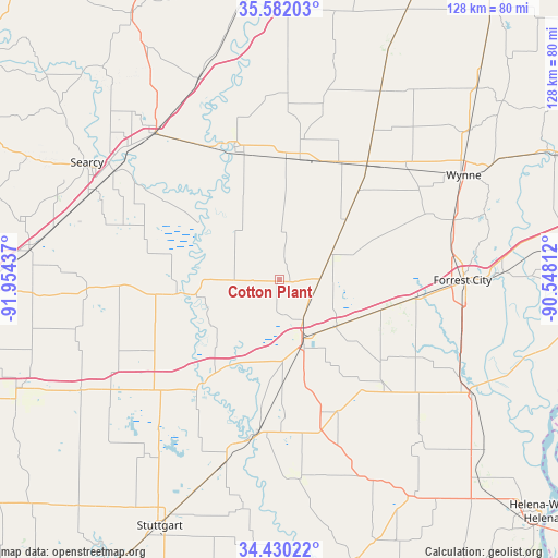
Cotton Plant GPS coordinates[2]
35° 0' 29.34" North, 91° 15' 4.464" West
| Map corner | latitude | longitude |
|---|---|---|
| Upper-left | 35.58203°, | -91.95437° |
| Center: | 35.00815°, | -91.25124° |
| Lower-right: | 34.43022°, | -90.54812° |
| Map W x H: | 128.1×128.1 km | = 79.6×79.6mi |
| max Lat: | 71.29058° ⇑75.4% North |
| Cotton Plant: | 35.00815° |
| min Lat: | ⇓24.6% South 19.06759° |
| min Long | Cotton Plant | max Long |
| -171.73463° | -91.25124° | -66.98998° |
| W 37.4%⇐ | ⇒62.6% E |
Elevation
Elevation of Cotton Plant is 65 m = 213 ft, and this is 229.8 m = 754 ft below average elevation for this country.
| Max E: |
3189 m = 10463 ft | 76.2% |
| Avg. | 294.8 m = 967 ft | |
| Cotton Plant | 65 m = 213 ft | |
Min E: |
-60 m = -197 ft | 23.8% |
See also: United States elevation on elevation.city.
Geographical zone
Cotton Plant is located in North temperate zone (between Tropic of Cancer and the Arctic Circle). Distance of this Northern Tropic circle is 1286.6 km =799.5 mi to South.| Distance of | km | miles | from Cotton Plant |
|---|---|---|---|
| North Pole | 6114.5 | 3799.4 | to North |
| Arctic Circle | 3508.6 | 2180.1 | to North |
| Tropic Cancer | 1286.6 | 799.5 | to South |
| Equator | 3892.5 | 2418.7 | to South |


Nearby cities:
15 places around Cotton Plant: (largest is in red/bold)
• Augusta
32.2 km =20 mi,  341°
341°
• Bald Knob
44.2 km =27.5 mi,  319°
319°
• Brinkley
14.3 km =8.9 mi,  158°
158°
• Clarendon
35.5 km =22.1 mi,  189°
189°
• De Valls Bluff
31.2 km =19.4 mi,  217°
217°
• Des Arc
22.5 km =14 mi,  261°
261°
• Forrest City
42 km =26.1 mi,  90°
90°
• Hazen
39.3 km =24.4 mi,  229°
229°
• Higginson
46.8 km =29.1 mi,  296°
296°
• Holly Grove
46.1 km =28.6 mi,  174°
174°
• Judsonia
45.8 km =28.5 mi,  309°
309°
• Kensett
45.3 km =28.1 mi, 303°
• Madison
48.1 km =29.9 mi, 89°
• McCrory
28 km =17.4 mi,  9°
9°
• Palestine
32 km =19.9 mi,  97°
97°
Sources, notices
• [Note1] Compared only with cities in United States existing in our database
• [Src1] Map data: © OpenStreetMap contributors (CC-BY-SA)
• [Src2] Other city data from geonames.org with taken over terms of usage.
• [Src3] Geographical zone / Annual Mean Temperature by Robert A. Rohde @ Wikipedia
