McCrory geodata
McCrory (Arkansas) is a populated place; located in United States in America/Chicago (GMT-5) time zone. With population of 1,601 people, there are 13295 cities with bigger population in this country. Compared to other cities in United States, 73.9% of cities are located further ↑North; 62.5% of cities are located further →East and 76.5% of cities have higher elevation than McCrory. Note1


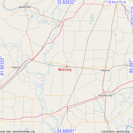
McCrory GPS coordinates[2]
35° 15' 22.32" North, 91° 12' 0.432" West
| Map corner | latitude | longitude |
|---|---|---|
| Upper-left | 35.82832°, | -91.90325° |
| Center: | 35.2562°, | -91.20012° |
| Lower-right: | 34.68001°, | -90.497° |
| Map W x H: | 127.7×127.7 km | = 79.3×79.3mi |
| max Lat: | 71.29058° ⇑73.9% North |
| McCrory: | 35.2562° |
| min Lat: | ⇓26.1% South 19.06759° |
| min Long | McCrory | max Long |
| -171.73463° | -91.20012° | -66.98998° |
| W 37.5%⇐ | ⇒62.5% E |
Elevation
Elevation of McCrory is 63 m = 207 ft, and this is 231.8 m = 760 ft below average elevation for this country.
| Max E: |
3189 m = 10463 ft | 76.5% |
| Avg. | 294.8 m = 967 ft | |
| McCrory | 63 m = 207 ft | |
Min E: |
-60 m = -197 ft | 23.5% |
See also: United States elevation on elevation.city.
Geographical zone
McCrory is located in North temperate zone (between Tropic of Cancer and the Arctic Circle). Distance of this Northern Tropic circle is 1314.2 km =816.6 mi to South.| Distance of | km | miles | from McCrory |
|---|---|---|---|
| North Pole | 6086.9 | 3782.2 | to North |
| Arctic Circle | 3481.1 | 2163.1 | to North |
| Tropic Cancer | 1314.2 | 816.6 | to South |
| Equator | 3920.1 | 2435.8 | to South |


Nearby cities:
15 places around McCrory: (largest is in red/bold)
• Augusta
15.3 km =9.5 mi,  280°
280°
• Bald Knob
33.9 km =21.1 mi, 280°
• Bradford
29.7 km =18.5 mi,  308°
308°
• Brinkley
41 km =25.5 mi,  179°
179°
• Cherry Valley
43.7 km =27.2 mi,  68°
68°
• Cotton Plant
28 km =17.4 mi,  189°
189°
• Des Arc
41 km =25.5 mi,  220°
220°
• Diaz
42.9 km =26.7 mi,  352°
352°
• Forrest City
46.4 km =28.8 mi,  126°
126°
• Higginson
47 km =29.2 mi,  261°
261°
• Judsonia
40 km =24.9 mi,  272°
272°
• Kensett
42.5 km =26.4 mi, 266°
• Newport
39.5 km =24.5 mi, 349°
• Palestine
41.6 km =25.8 mi,  139°
139°
• Wynne
37.7 km =23.4 mi,  95°
95°
Sources, notices
• [Note1] Compared only with cities in United States existing in our database
• [Src1] Map data: © OpenStreetMap contributors (CC-BY-SA)
• [Src2] Other city data from geonames.org with taken over terms of usage.
• [Src3] Geographical zone / Annual Mean Temperature by Robert A. Rohde @ Wikipedia
