Hermitage geodata
Hermitage (Arkansas) is a populated place; located in United States in America/Chicago (GMT-5) time zone. With population of 804 people, there are 17772 cities with bigger population in this country. Compared to other cities in United States, 83.4% of cities are located further ↑North; 64.5% of cities are located further →East and 76.9% of cities have higher elevation than Hermitage. Note1
Administrative division(s):
- Level 1: Arkansas
- Level 2: Bradley County
- Level 3: Township of Washington


Hermitage GPS coordinates[2]
33° 26' 47.4" North, 92° 10' 26.508" West
| Map corner | latitude | longitude |
|---|---|---|
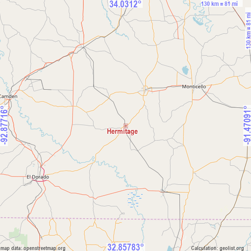
| Upper-left | 34.0312°, | -92.87716° |
| Center: | 33.4465°, | -92.17403° |
| Lower-right: | 32.85783°, | -91.47091° |
| Map W x H: | 130.5×130.5 km | = 81.1×81.1mi |
| max Lat: | 71.29058° ⇑83.4% North |
| Hermitage: | 33.4465° |
| min Lat: | ⇓16.6% South 19.06759° |
| min Long | Hermitage | max Long |
| -171.73463° | -92.17403° | -66.98998° |
| W 35.5%⇐ | ⇒64.5% E |
Elevation
Elevation of Hermitage is 61 m = 200 ft, and this is 233.8 m = 767 ft below average elevation for this country.
| Max E: |
3189 m = 10463 ft | 76.9% |
| Avg. | 294.8 m = 967 ft | |
| Hermitage | 61 m = 200 ft | |
Min E: |
-60 m = -197 ft | 23.1% |
See also: United States elevation on elevation.city.
Geographical zone
Hermitage is located in North temperate zone (between Tropic of Cancer and the Arctic Circle). Distance of this Northern Tropic circle is 1113 km =691.6 mi to South.| Distance of | km | miles | from Hermitage |
|---|---|---|---|
| North Pole | 6288.2 | 3907.3 | to North |
| Arctic Circle | 3682.3 | 2288.1 | to North |
| Tropic Cancer | 1113 | 691.6 | to South |
| Equator | 3718.9 | 2310.8 | to South |


Nearby cities:
15 places around Hermitage: (largest is in red/bold)
• Bearden
51.3 km =31.9 mi,  307°
307°
• Crossett
40.5 km =25.2 mi,  150°
150°
• El Dorado
52.9 km =32.9 mi,  239°
239°
• Fordyce
46.4 km =28.8 mi,  331°
331°
• Hamburg
42.6 km =26.5 mi,  124°
124°
• Hampton
29.3 km =18.2 mi,  290°
290°
• Huttig
45.3 km =28.1 mi,  181°
181°
• Monticello
40.9 km =25.4 mi,  60°
60°
• Norphlet
47.7 km =29.6 mi,  252°
252°
• North Crossett
38 km =23.6 mi, 145°
• Smackover
51.9 km =32.2 mi,  259°
259°
• Strong
40.5 km =25.2 mi,  201°
201°
• Warren
21.1 km =13.1 mi,  28°
28°
• West Crossett
37.9 km =23.5 mi, 153°
• Wilmar
30.3 km =18.8 mi,  47°
47°
Sources, notices
• [Note1] Compared only with cities in United States existing in our database
• [Src1] Map data: © OpenStreetMap contributors (CC-BY-SA)
• [Src2] Other city data from geonames.org with taken over terms of usage.
• [Src3] Geographical zone / Annual Mean Temperature by Robert A. Rohde @ Wikipedia
