Monette geodata
Monette (Arkansas) is a populated place; located in United States in America/Chicago (GMT-5) time zone. With population of 1,527 people, there are 13558 cities with bigger population in this country. Compared to other cities in United States, 70.9% of cities are located further ↑North; 60.3% of cities are located further →East and 74.7% of cities have higher elevation than Monette. Note1
Administrative division(s):
- Level 1: Arkansas
- Level 2: Craighead County
- Level 3: Township of Buffalo


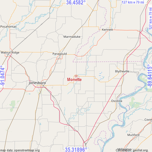
Monette GPS coordinates[2]
35° 53' 26.268" North, 90° 20' 39.372" West
| Map corner | latitude | longitude |
|---|---|---|
| Upper-left | 36.4582°, | -91.0474° |
| Center: | 35.89063°, | -90.34427° |
| Lower-right: | 35.31896°, | -89.64115° |
| Map W x H: | 126.7×126.7 km | = 78.7×78.7mi |
| max Lat: | 71.29058° ⇑70.9% North |
| Monette: | 35.89063° |
| min Lat: | ⇓29.1% South 19.06759° |
| min Long | Monette | max Long |
| -171.73463° | -90.34427° | -66.98998° |
| W 39.7%⇐ | ⇒60.3% E |
Elevation
Elevation of Monette is 73 m = 240 ft, and this is 221.8 m = 728 ft below average elevation for this country.
| Max E: |
3189 m = 10463 ft | 74.7% |
| Avg. | 294.8 m = 967 ft | |
| Monette | 73 m = 240 ft | |
Min E: |
-60 m = -197 ft | 25.3% |
See also: United States elevation on elevation.city.
Geographical zone
Monette is located in North temperate zone (between Tropic of Cancer and the Arctic Circle). Distance of this Northern Tropic circle is 1384.7 km =860.4 mi to South.| Distance of | km | miles | from Monette |
|---|---|---|---|
| North Pole | 6016.4 | 3738.4 | to North |
| Arctic Circle | 3410.5 | 2119.2 | to North |
| Tropic Cancer | 1384.7 | 860.4 | to South |
| Equator | 3990.7 | 2479.7 | to South |


Nearby cities:
15 places around Monette: (largest is in red/bold)
• Bay
25.7 km =16 mi,  230°
230°
• Brookland
21.4 km =13.3 mi,  272°
272°
• Caraway
14.9 km =9.3 mi,  172°
172°
• Cardwell
18 km =11.2 mi,  14°
14°
• Hornersville
26.7 km =16.6 mi,  50°
50°
• Jonesboro
32.9 km =20.4 mi,  260°
260°
• Keiser
32.6 km =20.3 mi,  137°
137°
• Lake City
11.6 km =7.2 mi,  224°
224°
• Leachville
9.3 km =5.8 mi,  57°
57°
• Lepanto
31.1 km =19.3 mi,  177°
177°
• Manila
16 km =9.9 mi,  94°
94°
• Oak Grove Heights
29.7 km =18.5 mi,  329°
329°
• Paragould
23.2 km =14.4 mi,  323°
323°
• Senath
31.8 km =19.8 mi,  31°
31°
• Trumann
28.3 km =17.6 mi,  211°
211°
Sources, notices
• [Note1] Compared only with cities in United States existing in our database
• [Src1] Map data: © OpenStreetMap contributors (CC-BY-SA)
• [Src2] Other city data from geonames.org with taken over terms of usage.
• [Src3] Geographical zone / Annual Mean Temperature by Robert A. Rohde @ Wikipedia
