Shaw geodata
Shaw (Washington, D.C.) is a populated place; located in United States in America/New_York (GMT-4) time zone. With population of 17,639 people, there are 2828 cities with bigger population in this country. Compared to other cities in United States, 55.7% of cities are located further ↑North; 80.5% of cities are located further ←West and 84.4% of cities have higher elevation than Shaw. Note1


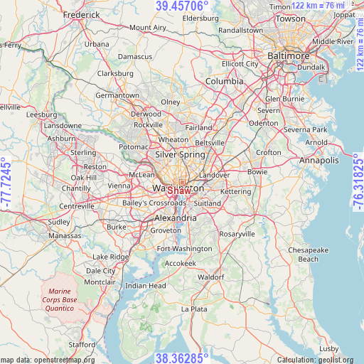
Shaw GPS coordinates[2]
38° 54' 43.416" North, 77° 1' 16.932" West
| Map corner | latitude | longitude |
|---|---|---|
| Upper-left | 39.45706°, | -77.7245° |
| Center: | 38.91206°, | -77.02137° |
| Lower-right: | 38.36285°, | -76.31825° |
| Map W x H: | 121.7×121.7 km | = 75.6×75.6mi |
| max Lat: | 71.29058° ⇑55.7% North |
| Shaw: | 38.91206° |
| min Lat: | ⇓44.3% South 19.06759° |
| min Long | Shaw | max Long |
| -171.73463° | -77.02137° | -66.98998° |
| W 80.5%⇐ | ⇒19.5% E |
Elevation
Elevation of Shaw is 30 m = 98 ft, and this is 264.8 m = 869 ft below average elevation for this country.
| Max E: |
3189 m = 10463 ft | 84.4% |
| Avg. | 294.8 m = 967 ft | |
| Shaw | 30 m = 98 ft | |
Min E: |
-60 m = -197 ft | 15.6% |
See also: United States elevation on elevation.city.
Geographical zone
Shaw is located in North temperate zone (between Tropic of Cancer and the Arctic Circle). Distance of this Northern Tropic circle is 1720.7 km =1069.2 mi to South.| Distance of | km | miles | from Shaw |
|---|---|---|---|
| North Pole | 5680.4 | 3529.6 | to North |
| Arctic Circle | 3074.6 | 1910.5 | to North |
| Tropic Cancer | 1720.7 | 1069.2 | to South |
| Equator | 4326.6 | 2688.4 | to South |


Nearby cities:
15 places around Shaw: (largest is in red/bold)
• Adams Morgan
2.1 km =1.3 mi,  300°
300°
• Arlington
8 km =5 mi,  244°
244°
• Bloomingdale
1 km =0.6 mi,  58°
58°
• Brentwood
6.6 km =4.1 mi, 58°
• Chevy Chase
7 km =4.3 mi,  325°
325°
• Chillum
6.3 km =3.9 mi,  24°
24°
• Colmar Manor
6.9 km =4.3 mi,  70°
70°
• Cottage City
7 km =4.3 mi, 65°
• Friendship Village
8.1 km =5 mi,  314°
314°
• Mount Rainier
5.9 km =3.7 mi, 56°
• North Brentwood
7.1 km =4.4 mi, 58°
• Queenstown
6.5 km =4 mi,  48°
48°
• Rosslyn
4.7 km =2.9 mi,  248°
248°
• Takoma Park
7.4 km =4.6 mi,  9°
9°
• Washington, D.C.
2.3 km =1.4 mi,  214°
214°
Sources, notices
• [Note1] Compared only with cities in United States existing in our database
• [Src1] Map data: © OpenStreetMap contributors (CC-BY-SA)
• [Src2] Other city data from geonames.org with taken over terms of usage.
• [Src3] Geographical zone / Annual Mean Temperature by Robert A. Rohde @ Wikipedia
