Omega geodata
Omega (Georgia) is a populated place; located in United States in America/New_York (GMT-4) time zone. With population of 1,230 people, there are 14960 cities with bigger population in this country. Compared to other cities in United States, 90% of cities are located further ↑North; 60.4% of cities are located further ←West and 70% of cities have higher elevation than Omega. Note1


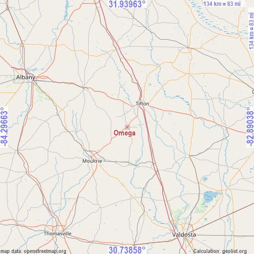
Omega GPS coordinates[2]
31° 20' 27.672" North, 83° 35' 36.6" West
| Map corner | latitude | longitude |
|---|---|---|
| Upper-left | 31.93963°, | -84.29663° |
| Center: | 31.34102°, | -83.5935° |
| Lower-right: | 30.73858°, | -82.89038° |
| Map W x H: | 133.5×133.5 km | = 83×83mi |
| max Lat: | 71.29058° ⇑90% North |
| Omega: | 31.34102° |
| min Lat: | ⇓10% South 19.06759° |
| min Long | Omega | max Long |
| -171.73463° | -83.5935° | -66.98998° |
| W 60.4%⇐ | ⇒39.6% E |
Elevation
Elevation of Omega is 101 m = 331 ft, and this is 193.8 m = 636 ft below average elevation for this country.
| Max E: |
3189 m = 10463 ft | 70% |
| Avg. | 294.8 m = 967 ft | |
| Omega | 101 m = 331 ft | |
Min E: |
-60 m = -197 ft | 30% |
See also: United States elevation on elevation.city.
Geographical zone
Omega is located in North temperate zone (between Tropic of Cancer and the Arctic Circle). Distance of this Northern Tropic circle is 878.9 km =546.1 mi to South.| Distance of | km | miles | from Omega |
|---|---|---|---|
| North Pole | 6522.3 | 4052.8 | to North |
| Arctic Circle | 3916.4 | 2433.5 | to North |
| Tropic Cancer | 878.9 | 546.1 | to South |
| Equator | 3484.8 | 2165.4 | to South |


Nearby cities:
15 places around Omega: (largest is in red/bold)
• Adel
27.8 km =17.3 mi,  144°
144°
• Alapaha
35.5 km =22.1 mi,  82°
82°
• Berlin
30.5 km =19 mi,  185°
185°
• Doerun
30.8 km =19.1 mi,  265°
265°
• Enigma
26.3 km =16.3 mi,  72°
72°
• Lenox
14.5 km =9 mi,  122°
122°
• Moultrie
25.8 km =16 mi,  226°
226°
• Norman Park
12 km =7.5 mi, 228°
• Phillipsburg
13 km =8.1 mi,  32°
32°
• Poulan
26.5 km =16.5 mi,  316°
316°
• Sparks
24.4 km =15.2 mi, 142°
• Sylvester
31.3 km =19.4 mi,  312°
312°
• Tifton
14.6 km =9.1 mi, 33°
• Ty Ty
15.4 km =9.6 mi,  340°
340°
• Unionville
13.1 km =8.1 mi,  37°
37°
Sources, notices
• [Note1] Compared only with cities in United States existing in our database
• [Src1] Map data: © OpenStreetMap contributors (CC-BY-SA)
• [Src2] Other city data from geonames.org with taken over terms of usage.
• [Src3] Geographical zone / Annual Mean Temperature by Robert A. Rohde @ Wikipedia
