Pembroke geodata
Pembroke (Georgia) is a seat of a second-order administrative division; located in United States in America/New_York (GMT-4) time zone. With population of 2,445 people, there are 10752 cities with bigger population in this country. Compared to other cities in United States, 88.3% of cities are located further ↑North; 67% of cities are located further ←West and 83.2% of cities have higher elevation than Pembroke. Note1


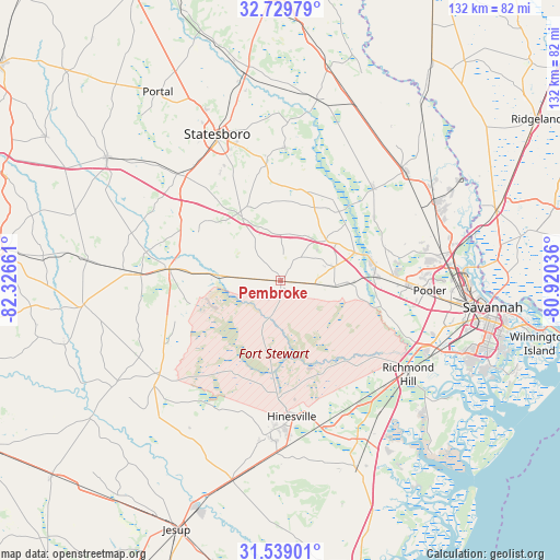
Pembroke GPS coordinates[2]
32° 8' 10.824" North, 81° 37' 24.528" West
| Map corner | latitude | longitude |
|---|---|---|
| Upper-left | 32.72979°, | -82.32661° |
| Center: | 32.13634°, | -81.62348° |
| Lower-right: | 31.53901°, | -80.92036° |
| Map W x H: | 132.4×132.4 km | = 82.3×82.3mi |
| max Lat: | 71.29058° ⇑88.3% North |
| Pembroke: | 32.13634° |
| min Lat: | ⇓11.7% South 19.06759° |
| min Long | Pembroke | max Long |
| -171.73463° | -81.62348° | -66.98998° |
| W 67%⇐ | ⇒33% E |
Elevation
Elevation of Pembroke is 34 m = 112 ft, and this is 260.8 m = 856 ft below average elevation for this country.
| Max E: |
3189 m = 10463 ft | 83.2% |
| Avg. | 294.8 m = 967 ft | |
| Pembroke | 34 m = 112 ft | |
Min E: |
-60 m = -197 ft | 16.8% |
See also: United States elevation on elevation.city.
Geographical zone
Pembroke is located in North temperate zone (between Tropic of Cancer and the Arctic Circle). Distance of this Northern Tropic circle is 967.3 km =601.1 mi to South.| Distance of | km | miles | from Pembroke |
|---|---|---|---|
| North Pole | 6433.8 | 3997.8 | to North |
| Arctic Circle | 3827.9 | 2378.5 | to North |
| Tropic Cancer | 967.3 | 601.1 | to South |
| Equator | 3573.2 | 2220.3 | to South |


Nearby cities:
15 places around Pembroke: (largest is in red/bold)
• Allenhurst
39.2 km =24.4 mi,  177°
177°
• Bloomingdale
30.6 km =19 mi,  90°
90°
• Brooklet
27.3 km =17 mi,  352°
352°
• Claxton
26.6 km =16.5 mi,  276°
276°
• Flemington
31.3 km =19.4 mi,  169°
169°
• Fort Stewart
29.4 km =18.3 mi, 177°
• Glennville
36.3 km =22.6 mi,  232°
232°
• Guyton
31.2 km =19.4 mi,  44°
44°
• Hagan
29.3 km =18.2 mi,  274°
274°
• Henderson
37.2 km =23.1 mi,  112°
112°
• Hinesville
32.3 km =20.1 mi, 175°
• Pooler
35.5 km =22.1 mi, 93°
• Richmond Hill
37.3 km =23.2 mi,  126°
126°
• Springfield
39.4 km =24.5 mi,  48°
48°
• Statesboro
37.8 km =23.5 mi,  336°
336°
Sources, notices
• [Note1] Compared only with cities in United States existing in our database
• [Src1] Map data: © OpenStreetMap contributors (CC-BY-SA)
• [Src2] Other city data from geonames.org with taken over terms of usage.
• [Src3] Geographical zone / Annual Mean Temperature by Robert A. Rohde @ Wikipedia
