Allenhurst geodata
Allenhurst (Georgia) is a populated place; located in United States in America/New_York (GMT-4) time zone. With population of 665 people, there are 19022 cities with bigger population in this country. Compared to other cities in United States, 89% of cities are located further ↑North; 67.1% of cities are located further ←West and 87% of cities have higher elevation than Allenhurst. Note1


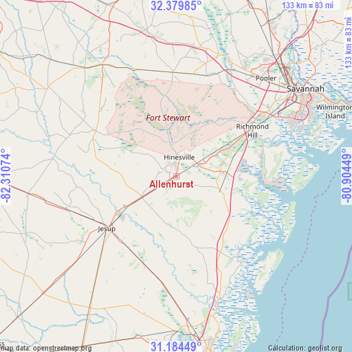
Allenhurst GPS coordinates[2]
31° 47' 2.76" North, 81° 36' 27.396" West
| Map corner | latitude | longitude |
|---|---|---|
| Upper-left | 32.37985°, | -82.31074° |
| Center: | 31.7841°, | -81.60761° |
| Lower-right: | 31.18449°, | -80.90449° |
| Map W x H: | 132.9×132.9 km | = 82.6×82.6mi |
| max Lat: | 71.29058° ⇑89% North |
| Allenhurst: | 31.7841° |
| min Lat: | ⇓11% South 19.06759° |
| min Long | Allenhurst | max Long |
| -171.73463° | -81.60761° | -66.98998° |
| W 67.1%⇐ | ⇒32.9% E |
Elevation
Elevation of Allenhurst is 23 m = 75 ft, and this is 271.8 m = 892 ft below average elevation for this country.
| Max E: |
3189 m = 10463 ft | 87% |
| Avg. | 294.8 m = 967 ft | |
| Allenhurst | 23 m = 75 ft | |
Min E: |
-60 m = -197 ft | 13% |
See also: United States elevation on elevation.city.
Geographical zone
Allenhurst is located in North temperate zone (between Tropic of Cancer and the Arctic Circle). Distance of this Northern Tropic circle is 928.1 km =576.7 mi to South.| Distance of | km | miles | from Allenhurst |
|---|---|---|---|
| North Pole | 6473 | 4022.1 | to North |
| Arctic Circle | 3867.1 | 2402.9 | to North |
| Tropic Cancer | 928.1 | 576.7 | to South |
| Equator | 3534.1 | 2196 | to South |


Nearby cities:
15 places around Allenhurst: (largest is in red/bold)
• Bloomingdale
48.5 km =30.1 mi,  36°
36°
• Flemington
9.4 km =5.8 mi,  26°
26°
• Fort Stewart
9.8 km =6.1 mi,  358°
358°
• Georgetown
42.2 km =26.2 mi,  58°
58°
• Glennville
34.7 km =21.6 mi,  299°
299°
• Henderson
41.3 km =25.7 mi,  52°
52°
• Hinesville
7.1 km =4.4 mi,  8°
8°
• Jesup
32.9 km =20.4 mi,  233°
233°
• Ludowici
15.3 km =9.5 mi,  236°
236°
• Midway
16.9 km =10.5 mi,  81°
81°
• Odum
41.9 km =26 mi,  251°
251°
• Pembroke
39.2 km =24.4 mi, 357°
• Riceboro
17.3 km =10.7 mi,  108°
108°
• Richmond Hill
33.5 km =20.8 mi, 59°
• Walthourville
2.6 km =1.6 mi, 244°
Sources, notices
• [Note1] Compared only with cities in United States existing in our database
• [Src1] Map data: © OpenStreetMap contributors (CC-BY-SA)
• [Src2] Other city data from geonames.org with taken over terms of usage.
• [Src3] Geographical zone / Annual Mean Temperature by Robert A. Rohde @ Wikipedia
