Uvalda geodata
Uvalda (Georgia) is a populated place; located in United States in America/New_York (GMT-4) time zone. With population of 585 people, there are 19860 cities with bigger population in this country. Compared to other cities in United States, 88.5% of cities are located further ↑North; 63.7% of cities are located further ←West and 78.2% of cities have higher elevation than Uvalda. Note1


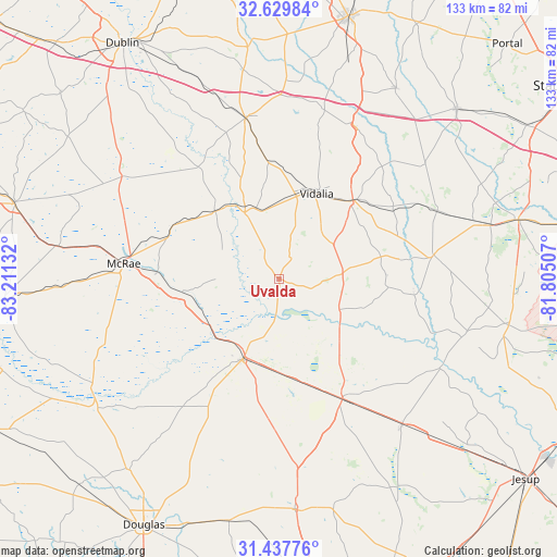
Uvalda GPS coordinates[2]
32° 2' 8.664" North, 82° 30' 29.484" West
| Map corner | latitude | longitude |
|---|---|---|
| Upper-left | 32.62984°, | -83.21132° |
| Center: | 32.03574°, | -82.50819° |
| Lower-right: | 31.43776°, | -81.80507° |
| Map W x H: | 132.5×132.5 km | = 82.3×82.3mi |
| max Lat: | 71.29058° ⇑88.5% North |
| Uvalda: | 32.03574° |
| min Lat: | ⇓11.5% South 19.06759° |
| min Long | Uvalda | max Long |
| -171.73463° | -82.50819° | -66.98998° |
| W 63.7%⇐ | ⇒36.3% E |
Elevation
Elevation of Uvalda is 55 m = 180 ft, and this is 239.8 m = 787 ft below average elevation for this country.
| Max E: |
3189 m = 10463 ft | 78.2% |
| Avg. | 294.8 m = 967 ft | |
| Uvalda | 55 m = 180 ft | |
Min E: |
-60 m = -197 ft | 21.8% |
See also: United States elevation on elevation.city.
Geographical zone
Uvalda is located in North temperate zone (between Tropic of Cancer and the Arctic Circle). Distance of this Northern Tropic circle is 956.1 km =594.1 mi to South.| Distance of | km | miles | from Uvalda |
|---|---|---|---|
| North Pole | 6445 | 4004.7 | to North |
| Arctic Circle | 3839.1 | 2385.5 | to North |
| Tropic Cancer | 956.1 | 594.1 | to South |
| Equator | 3562 | 2213.3 | to South |


Nearby cities:
15 places around Uvalda: (largest is in red/bold)
• Ailey
17.7 km =11 mi,  342°
342°
• Alamo
28.3 km =17.6 mi,  295°
295°
• Baxley
32.4 km =20.1 mi,  152°
152°
• Collins
40.9 km =25.4 mi,  66°
66°
• Glenwood
22.1 km =13.7 mi,  316°
316°
• Hazlehurst
20.2 km =12.6 mi,  203°
203°
• Helena
38.5 km =23.9 mi,  276°
276°
• Lumber City
20 km =12.4 mi,  233°
233°
• Lyons
25.7 km =16 mi,  43°
43°
• McRae
37.2 km =23.1 mi, 275°
• Milan
52.3 km =32.5 mi,  267°
267°
• Mount Vernon
17.8 km =11.1 mi,  332°
332°
• Reidsville
37.2 km =23.1 mi,  81°
81°
• Soperton
38.8 km =24.1 mi,  348°
348°
• Vidalia
22.1 km =13.7 mi,  23°
23°
Sources, notices
• [Note1] Compared only with cities in United States existing in our database
• [Src1] Map data: © OpenStreetMap contributors (CC-BY-SA)
• [Src2] Other city data from geonames.org with taken over terms of usage.
• [Src3] Geographical zone / Annual Mean Temperature by Robert A. Rohde @ Wikipedia
