Cerro Gordo geodata
Cerro Gordo (Illinois) is a populated place; located in United States in America/Chicago (GMT-5) time zone. With population of 1,353 people, there are 14333 cities with bigger population in this country. Compared to other cities in United States, 52.4% of cities are located further ↓South; 55.4% of cities are located further →East and 57.9% of cities have lower elevation than Cerro Gordo. Note1
Administrative division(s):
- Level 1: Illinois
- Level 2: Piatt County
- Level 3: Township of Cerro Gordo


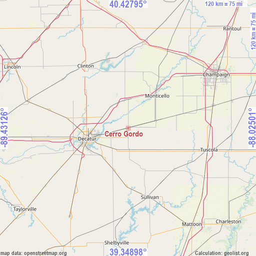
Cerro Gordo GPS coordinates[2]
39° 53' 26.124" North, 88° 43' 41.268" West
| Map corner | latitude | longitude |
|---|---|---|
| Upper-left | 40.42795°, | -89.43126° |
| Center: | 39.89059°, | -88.72813° |
| Lower-right: | 39.34898°, | -88.02501° |
| Map W x H: | 120×120 km | = 74.6×74.6mi |
| max Lat: | 71.29058° ⇑47.6% North |
| Cerro Gordo: | 39.89059° |
| min Lat: | ⇓52.4% South 19.06759° |
| min Long | Cerro Gordo | max Long |
| -171.73463° | -88.72813° | -66.98998° |
| W 44.6%⇐ | ⇒55.4% E |
Elevation
Elevation of Cerro Gordo is 230 m = 755 ft, and this is 64.8 m = 213 ft below average elevation for this country.
| Max E: |
3189 m = 10463 ft | 42.1% |
| Avg. | 294.8 m = 967 ft | |
| Cerro Gordo | 230 m = 755 ft | |
Min E: |
-60 m = -197 ft | 57.9% |
See also: United States elevation on elevation.city.
Geographical zone
Cerro Gordo is located in North temperate zone (between Tropic of Cancer and the Arctic Circle). Distance of this Northern Tropic circle is 1829.5 km =1136.8 mi to South.| Distance of | km | miles | from Cerro Gordo |
|---|---|---|---|
| North Pole | 5571.6 | 3462 | to North |
| Arctic Circle | 2965.8 | 1842.9 | to North |
| Tropic Cancer | 1829.5 | 1136.8 | to South |
| Equator | 4435.4 | 2756 | to South |


Nearby cities:
15 places around Cerro Gordo: (largest is in red/bold)
• Argenta
13 km =8.1 mi,  321°
321°
• Atwood
24.9 km =15.5 mi,  114°
114°
• Bement
13.8 km =8.6 mi,  75°
75°
• Bethany
27.3 km =17 mi,  181°
181°
• Chapin
4 km =2.5 mi,  255°
255°
• Dalton City
20.9 km =13 mi,  198°
198°
• Decatur
20.1 km =12.5 mi,  253°
253°
• Forsyth
19.6 km =12.2 mi,  283°
283°
• Long Creek
13.4 km =8.3 mi,  229°
229°
• Lovington
21.1 km =13.1 mi,  157°
157°
• Maroa
25.4 km =15.8 mi,  309°
309°
• Monticello
20.2 km =12.6 mi,  40°
40°
• Mount Zion
18.2 km =11.3 mi,  223°
223°
• Oreana
12.9 km =8 mi,  294°
294°
• Warrensburg
28.9 km =18 mi, 279°
Sources, notices
• [Note1] Compared only with cities in United States existing in our database
• [Src1] Map data: © OpenStreetMap contributors (CC-BY-SA)
• [Src2] Other city data from geonames.org with taken over terms of usage.
• [Src3] Geographical zone / Annual Mean Temperature by Robert A. Rohde @ Wikipedia
