Germantown geodata
Germantown (Illinois) is a populated place; located in United States in America/Chicago (GMT-5) time zone. With population of 1,285 people, there are 14661 cities with bigger population in this country. Compared to other cities in United States, 58.4% of cities are located further ↑North; 57.6% of cities are located further →East and 64% of cities have higher elevation than Germantown. Note1
Administrative division(s):
- Level 1: Illinois
- Level 2: Clinton County
- Level 3: Township of Germantown


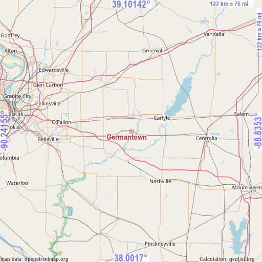
Germantown GPS coordinates[2]
38° 33' 13.176" North, 89° 32' 18.312" West
| Map corner | latitude | longitude |
|---|---|---|
| Upper-left | 39.10142°, | -90.24155° |
| Center: | 38.55366°, | -89.53842° |
| Lower-right: | 38.0017°, | -88.8353° |
| Map W x H: | 122.3×122.3 km | = 76×76mi |
| max Lat: | 71.29058° ⇑58.4% North |
| Germantown: | 38.55366° |
| min Lat: | ⇓41.6% South 19.06759° |
| min Long | Germantown | max Long |
| -171.73463° | -89.53842° | -66.98998° |
| W 42.4%⇐ | ⇒57.6% E |
Elevation
Elevation of Germantown is 133 m = 436 ft, and this is 161.8 m = 531 ft below average elevation for this country.
| Max E: |
3189 m = 10463 ft | 64% |
| Avg. | 294.8 m = 967 ft | |
| Germantown | 133 m = 436 ft | |
Min E: |
-60 m = -197 ft | 36% |
See also: United States elevation on elevation.city.
Geographical zone
Germantown is located in North temperate zone (between Tropic of Cancer and the Arctic Circle). Distance of this Northern Tropic circle is 1680.8 km =1044.4 mi to South.| Distance of | km | miles | from Germantown |
|---|---|---|---|
| North Pole | 5720.3 | 3554.4 | to North |
| Arctic Circle | 3114.4 | 1935.2 | to North |
| Tropic Cancer | 1680.8 | 1044.4 | to South |
| Equator | 4286.8 | 2663.7 | to South |


Nearby cities:
15 places around Germantown: (largest is in red/bold)
• Albers
6.5 km =4 mi,  259°
259°
• Aviston
8.4 km =5.2 mi,  314°
314°
• Bartelso
6.5 km =4 mi,  107°
107°
• Beckemeyer
10.6 km =6.6 mi,  57°
57°
• Breese
6.4 km =4 mi,  8°
8°
• Carlyle
15.7 km =9.8 mi,  66°
66°
• Highland
23.7 km =14.7 mi,  330°
330°
• Lebanon
24 km =14.9 mi,  283°
283°
• Mascoutah
23.3 km =14.5 mi,  252°
252°
• New Baden
14.3 km =8.9 mi, 261°
• Okawville
13.3 km =8.3 mi,  184°
184°
• Pierron
24.8 km =15.4 mi,  3°
3°
• Pierron
25.7 km =16 mi,  348°
348°
• Saint Libory
26 km =16.2 mi,  215°
215°
• Trenton
13.8 km =8.6 mi,  294°
294°
Sources, notices
• [Note1] Compared only with cities in United States existing in our database
• [Src1] Map data: © OpenStreetMap contributors (CC-BY-SA)
• [Src2] Other city data from geonames.org with taken over terms of usage.
• [Src3] Geographical zone / Annual Mean Temperature by Robert A. Rohde @ Wikipedia
