Hillsboro geodata
Hillsboro (Illinois) is a seat of a second-order administrative division; located in United States in America/Chicago (GMT-5) time zone. With population of 5,726 people, there are 6595 cities with bigger population in this country. Compared to other cities in United States, 53.3% of cities are located further ↑North; 57.5% of cities are located further →East and 52.2% of cities have higher elevation than Hillsboro. Note1
Administrative division(s):
- Level 1: Illinois
- Level 2: Montgomery County
- Level 3: Township of Hillsboro


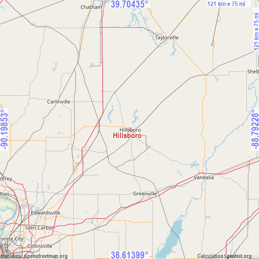
Hillsboro GPS coordinates[2]
39° 9' 40.608" North, 89° 29' 43.44" West
| Map corner | latitude | longitude |
|---|---|---|
| Upper-left | 39.70435°, | -90.19853° |
| Center: | 39.16128°, | -89.4954° |
| Lower-right: | 38.61399°, | -88.79228° |
| Map W x H: | 121.2×121.2 km | = 75.3×75.3mi |
| max Lat: | 71.29058° ⇑53.3% North |
| Hillsboro: | 39.16128° |
| min Lat: | ⇓46.7% South 19.06759° |
| min Long | Hillsboro | max Long |
| -171.73463° | -89.4954° | -66.98998° |
| W 42.5%⇐ | ⇒57.5% E |
Elevation
Elevation of Hillsboro is 190 m = 623 ft, and this is 104.8 m = 344 ft below average elevation for this country.
| Max E: |
3189 m = 10463 ft | 52.2% |
| Avg. | 294.8 m = 967 ft | |
| Hillsboro | 190 m = 623 ft | |
Min E: |
-60 m = -197 ft | 47.8% |
See also: United States elevation on elevation.city.
Geographical zone
Hillsboro is located in North temperate zone (between Tropic of Cancer and the Arctic Circle). Distance of this Northern Tropic circle is 1748.4 km =1086.4 mi to South.| Distance of | km | miles | from Hillsboro |
|---|---|---|---|
| North Pole | 5652.7 | 3512.4 | to North |
| Arctic Circle | 3046.8 | 1893.2 | to North |
| Tropic Cancer | 1748.4 | 1086.4 | to South |
| Equator | 4354.3 | 2705.6 | to South |


Nearby cities:
15 places around Hillsboro: (largest is in red/bold)
• Benld
27.7 km =17.2 mi,  254°
254°
• Coffeen
12.1 km =7.5 mi,  131°
131°
• Gillespie
28.2 km =17.5 mi,  262°
262°
• Greenville
30.7 km =19.1 mi,  166°
166°
• Litchfield
13.8 km =8.6 mi,  276°
276°
• Livingston
31.6 km =19.6 mi,  227°
227°
• Morrisonville
29 km =18 mi,  6°
6°
• Mount Olive
22.3 km =13.9 mi,  243°
243°
• Mulberry Grove
32.7 km =20.3 mi,  143°
143°
• Nokomis
23.9 km =14.9 mi,  49°
49°
• Raymond
18.8 km =11.7 mi,  339°
339°
• Schram City
2.8 km =1.7 mi,  83°
83°
• Staunton
30.4 km =18.9 mi, 237°
• Taylor Springs
3.4 km =2.1 mi,  175°
175°
• Witt
16.5 km =10.3 mi, 50°
Sources, notices
• [Note1] Compared only with cities in United States existing in our database
• [Src1] Map data: © OpenStreetMap contributors (CC-BY-SA)
• [Src2] Other city data from geonames.org with taken over terms of usage.
• [Src3] Geographical zone / Annual Mean Temperature by Robert A. Rohde @ Wikipedia
