Smithton geodata
Smithton (Illinois) is a populated place; located in United States in America/Chicago (GMT-5) time zone. With population of 3,719 people, there are 8567 cities with bigger population in this country. Compared to other cities in United States, 59.3% of cities are located further ↑North; 59% of cities are located further →East and 61.9% of cities have higher elevation than Smithton. Note1
Administrative division(s):
- Level 1: Illinois
- Level 2: Saint Clair County
- Level 3: Township of Smithton


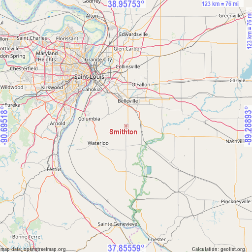
Smithton GPS coordinates[2]
38° 24' 31.176" North, 89° 59' 31.38" West
| Map corner | latitude | longitude |
|---|---|---|
| Upper-left | 38.95753°, | -90.69518° |
| Center: | 38.40866°, | -89.99205° |
| Lower-right: | 37.85559°, | -89.28893° |
| Map W x H: | 122.5×122.5 km | = 76.1×76.1mi |
| max Lat: | 71.29058° ⇑59.3% North |
| Smithton: | 38.40866° |
| min Lat: | ⇓40.7% South 19.06759° |
| min Long | Smithton | max Long |
| -171.73463° | -89.99205° | -66.98998° |
| W 41%⇐ | ⇒59% E |
Elevation
Elevation of Smithton is 145 m = 476 ft, and this is 149.8 m = 491 ft below average elevation for this country.
| Max E: |
3189 m = 10463 ft | 61.9% |
| Avg. | 294.8 m = 967 ft | |
| Smithton | 145 m = 476 ft | |
Min E: |
-60 m = -197 ft | 38.1% |
See also: United States elevation on elevation.city.
Geographical zone
Smithton is located in North temperate zone (between Tropic of Cancer and the Arctic Circle). Distance of this Northern Tropic circle is 1664.7 km =1034.4 mi to South.| Distance of | km | miles | from Smithton |
|---|---|---|---|
| North Pole | 5736.4 | 3564.4 | to North |
| Arctic Circle | 3130.5 | 1945.2 | to North |
| Tropic Cancer | 1664.7 | 1034.4 | to South |
| Equator | 4270.6 | 2653.6 | to South |


Nearby cities:
15 places around Smithton: (largest is in red/bold)
• Belleville
12.4 km =7.7 mi,  3°
3°
• Centreville
22.6 km =14 mi,  329°
329°
• Columbia
18.6 km =11.6 mi,  282°
282°
• Dupo
22.5 km =14 mi,  302°
302°
• Fairview Heights
20 km =12.4 mi, 0°
• Freeburg
7.1 km =4.4 mi,  72°
72°
• Mascoutah
19.6 km =12.2 mi,  62°
62°
• Millstadt
10.5 km =6.5 mi, 304°
• New Athens
13.6 km =8.5 mi,  132°
132°
• O'Fallon
21.6 km =13.4 mi,  19°
19°
• Red Bud
21.9 km =13.6 mi,  180°
180°
• Scott Air Force Base
19.3 km =12 mi,  39°
39°
• Shiloh
18.9 km =11.7 mi,  25°
25°
• Swansea
13.9 km =8.6 mi, 1°
• Waterloo
16 km =9.9 mi,  239°
239°
Sources, notices
• [Note1] Compared only with cities in United States existing in our database
• [Src1] Map data: © OpenStreetMap contributors (CC-BY-SA)
• [Src2] Other city data from geonames.org with taken over terms of usage.
• [Src3] Geographical zone / Annual Mean Temperature by Robert A. Rohde @ Wikipedia
