Brooklyn geodata
Brooklyn (Indiana) is a populated place; located in United States in America/Indiana/Indianapolis (GMT-4) time zone. With population of 1,601 people, there are 13295 cities with bigger population in this country. Compared to other cities in United States, 50.6% of cities are located further ↑North; 51.9% of cities are located further ←West and 52.2% of cities have lower elevation than Brooklyn. Note1


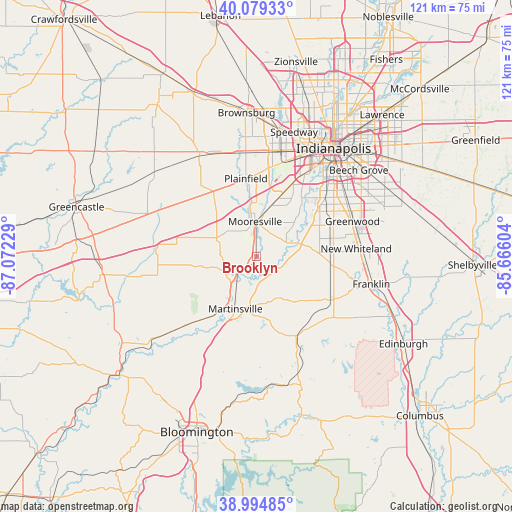
Brooklyn GPS coordinates[2]
39° 32' 21.156" North, 86° 22' 8.976" West
| Map corner | latitude | longitude |
|---|---|---|
| Upper-left | 40.07933°, | -87.07229° |
| Center: | 39.53921°, | -86.36916° |
| Lower-right: | 38.99485°, | -85.66604° |
| Map W x H: | 120.6×120.6 km | = 74.9×74.9mi |
| max Lat: | 71.29058° ⇑50.6% North |
| Brooklyn: | 39.53921° |
| min Lat: | ⇓49.4% South 19.06759° |
| min Long | Brooklyn | max Long |
| -171.73463° | -86.36916° | -66.98998° |
| W 51.9%⇐ | ⇒48.1% E |
Elevation
Elevation of Brooklyn is 207 m = 679 ft, and this is 87.8 m = 288 ft below average elevation for this country.
| Max E: |
3189 m = 10463 ft | 47.8% |
| Avg. | 294.8 m = 967 ft | |
| Brooklyn | 207 m = 679 ft | |
Min E: |
-60 m = -197 ft | 52.2% |
See also: United States elevation on elevation.city.
Geographical zone
Brooklyn is located in North temperate zone (between Tropic of Cancer and the Arctic Circle). Distance of this Northern Tropic circle is 1790.4 km =1112.5 mi to South.| Distance of | km | miles | from Brooklyn |
|---|---|---|---|
| North Pole | 5610.7 | 3486.3 | to North |
| Arctic Circle | 3004.8 | 1867.1 | to North |
| Tropic Cancer | 1790.4 | 1112.5 | to South |
| Equator | 4396.3 | 2731.7 | to South |


Nearby cities:
15 places around Brooklyn: (largest is in red/bold)
• Bargersville
17.4 km =10.8 mi,  96°
96°
• Clayton
21.2 km =13.2 mi,  321°
321°
• Greenwood
24 km =14.9 mi,  69°
69°
• Homecroft
25 km =15.5 mi,  54°
54°
• Martinsville
13.4 km =8.3 mi,  202°
202°
• Monrovia
10.7 km =6.6 mi,  294°
294°
• Mooresville
8.2 km =5.1 mi,  357°
357°
• Morgantown
20.8 km =12.9 mi,  153°
153°
• New Whiteland
23.6 km =14.7 mi,  84°
84°
• Painted Hills
16.1 km =10 mi,  172°
172°
• Paragon
23.1 km =14.4 mi,  225°
225°
• Plainfield
18.5 km =11.5 mi,  351°
351°
• Trafalgar
23.2 km =14.4 mi,  126°
126°
• Waterloo
14.9 km =9.3 mi, 80°
• Whiteland
24.8 km =15.4 mi,  87°
87°
Sources, notices
• [Note1] Compared only with cities in United States existing in our database
• [Src1] Map data: © OpenStreetMap contributors (CC-BY-SA)
• [Src2] Other city data from geonames.org with taken over terms of usage.
• [Src3] Geographical zone / Annual Mean Temperature by Robert A. Rohde @ Wikipedia
