Greenwood geodata
Greenwood (Indiana) is a populated place; located in United States in America/Indiana/Indianapolis (GMT-4) time zone. With population of 55,586 people, there are 824 cities with bigger population in this country. Compared to other cities in United States, 50% of cities are located further ↓South; 52.6% of cities are located further ←West and 61.4% of cities have lower elevation than Greenwood. Note1


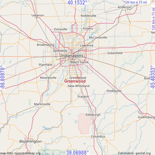
Greenwood GPS coordinates[2]
39° 36' 49.176" North, 86° 6' 23.94" West
| Map corner | latitude | longitude |
|---|---|---|
| Upper-left | 40.1532°, | -86.80978° |
| Center: | 39.61366°, | -86.10665° |
| Lower-right: | 39.06988°, | -85.40353° |
| Map W x H: | 120.5×120.5 km | = 74.9×74.9mi |
| max Lat: | 71.29058° ⇑50% North |
| Greenwood: | 39.61366° |
| min Lat: | ⇓50% South 19.06759° |
| min Long | Greenwood | max Long |
| -171.73463° | -86.10665° | -66.98998° |
| W 52.6%⇐ | ⇒47.4% E |
Elevation
Elevation of Greenwood is 246 m = 807 ft, and this is 48.8 m = 160 ft below average elevation for this country.
| Max E: |
3189 m = 10463 ft | 38.6% |
| Avg. | 294.8 m = 967 ft | |
| Greenwood | 246 m = 807 ft | |
Min E: |
-60 m = -197 ft | 61.4% |
See also: Greenwood elevation on elevation.city.
Geographical zone
Greenwood is located in North temperate zone (between Tropic of Cancer and the Arctic Circle). Distance of this Northern Tropic circle is 1798.7 km =1117.7 mi to South.| Distance of | km | miles | from Greenwood |
|---|---|---|---|
| North Pole | 5602.4 | 3481.2 | to North |
| Arctic Circle | 2996.5 | 1861.9 | to North |
| Tropic Cancer | 1798.7 | 1117.7 | to South |
| Equator | 4404.6 | 2736.9 | to South |


Nearby cities:
15 places around Greenwood: (largest is in red/bold)
• Bargersville
11.6 km =7.2 mi,  206°
206°
• Beech Grove
12.1 km =7.5 mi,  6°
6°
• Cumberland
22.1 km =13.7 mi,  35°
35°
• Fairland
21.1 km =13.1 mi,  98°
98°
• Franklin
15.4 km =9.6 mi,  163°
163°
• Homecroft
6.6 km =4.1 mi,  341°
341°
• Indianapolis
17.8 km =11.1 mi,  345°
345°
• Mooresville
22.9 km =14.2 mi,  269°
269°
• New Palestine
22.2 km =13.8 mi,  57°
57°
• New Whiteland
6.3 km =3.9 mi,  171°
171°
• Southport
6 km =3.7 mi, 342°
• Trafalgar
22.3 km =13.9 mi,  189°
189°
• Warren Park
19.3 km =12 mi, 14°
• Waterloo
9.6 km =6 mi,  233°
233°
• Whiteland
7.4 km =4.6 mi, 161°
Sources, notices
• [Note1] Compared only with cities in United States existing in our database
• [Src1] Map data: © OpenStreetMap contributors (CC-BY-SA)
• [Src2] Other city data from geonames.org with taken over terms of usage.
• [Src3] Geographical zone / Annual Mean Temperature by Robert A. Rohde @ Wikipedia
