Brownstown geodata
Brownstown (Indiana) is a seat of a second-order administrative division; located in United States in America/Indiana/Indianapolis (GMT-4) time zone. With population of 2,952 people, there are 9715 cities with bigger population in this country. Compared to other cities in United States, 56% of cities are located further ↑North; 52.8% of cities are located further ←West and 51.9% of cities have higher elevation than Brownstown. Note1
Administrative division(s):
- Level 1: Indiana
- Level 2: Jackson County
- Level 3: Township of Brownstown


Brownstown GPS coordinates[2]
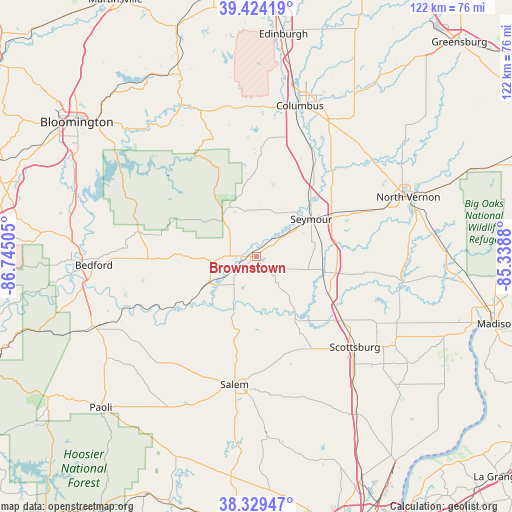
38° 52' 44.184" North, 86° 2' 30.912" West
| Map corner | latitude | longitude |
|---|---|---|
| Upper-left | 39.42419°, | -86.74505° |
| Center: | 38.87894°, | -86.04192° |
| Lower-right: | 38.32947°, | -85.3388° |
| Map W x H: | 121.7×121.7 km | = 75.6×75.6mi |
| max Lat: | 71.29058° ⇑56% North |
| Brownstown: | 38.87894° |
| min Lat: | ⇓44% South 19.06759° |
| min Long | Brownstown | max Long |
| -171.73463° | -86.04192° | -66.98998° |
| W 52.8%⇐ | ⇒47.2% E |
Elevation
Elevation of Brownstown is 191 m = 627 ft, and this is 103.8 m = 341 ft below average elevation for this country.
| Max E: |
3189 m = 10463 ft | 51.9% |
| Avg. | 294.8 m = 967 ft | |
| Brownstown | 191 m = 627 ft | |
Min E: |
-60 m = -197 ft | 48.1% |
See also: United States elevation on elevation.city.
Geographical zone
Brownstown is located in North temperate zone (between Tropic of Cancer and the Arctic Circle). Distance of this Northern Tropic circle is 1717 km =1066.9 mi to South.| Distance of | km | miles | from Brownstown |
|---|---|---|---|
| North Pole | 5684.1 | 3531.9 | to North |
| Arctic Circle | 3078.2 | 1912.7 | to North |
| Tropic Cancer | 1717 | 1066.9 | to South |
| Equator | 4322.9 | 2686.1 | to South |


Nearby cities:
15 places around Brownstown: (largest is in red/bold)
• Austin
24.3 km =15.1 mi,  123°
123°
• Bedford
38.6 km =24 mi,  267°
267°
• Campbellsburg
31.6 km =19.6 mi,  216°
216°
• Columbus
37.3 km =23.2 mi,  16°
16°
• Country Squire Lakes
34.4 km =21.4 mi,  59°
59°
• Crothersville
19.4 km =12.1 mi, 116°
• Elizabethtown
34.7 km =21.6 mi,  34°
34°
• Hayden
28.5 km =17.7 mi,  66°
66°
• Medora
12.6 km =7.8 mi,  241°
241°
• Mitchell
40.8 km =25.4 mi,  246°
246°
• Nashville
40.7 km =25.3 mi,  333°
333°
• North Vernon
38.8 km =24.1 mi, 68°
• Salem
30.8 km =19.1 mi,  189°
189°
• Scottsburg
31.9 km =19.8 mi,  132°
132°
• Seymour
15.9 km =9.9 mi, 55°
Sources, notices
• [Note1] Compared only with cities in United States existing in our database
• [Src1] Map data: © OpenStreetMap contributors (CC-BY-SA)
• [Src2] Other city data from geonames.org with taken over terms of usage.
• [Src3] Geographical zone / Annual Mean Temperature by Robert A. Rohde @ Wikipedia
